A Natural Adventure through The Mackay Region
Highlights
- Discover stunning landscapes as you traverse the rugged trails of Cape Palmerston National Park.
- Breathe in the fresh coastal air while relaxing on pristine beaches at Windmill Bay.
- Experience the tranquillity of dense rainforests and open woodlands in the Mackay Region.
- Cast a line in Cape Creek's serene waters, where bream and flathead await the keen angler.
Escape the modern world with a rugged and remote adventure to lift your spirits and clear your mind. Soak up splendid isolation, peace and tranquility amongst the remoteness of the Mackay Region’s National Parks! See a variety of open woodlands, dense rainforests, mangroves and gullies of paperbark trees all growing towards a beautiful, picturesque coastline.
Images and Video

Itineraries
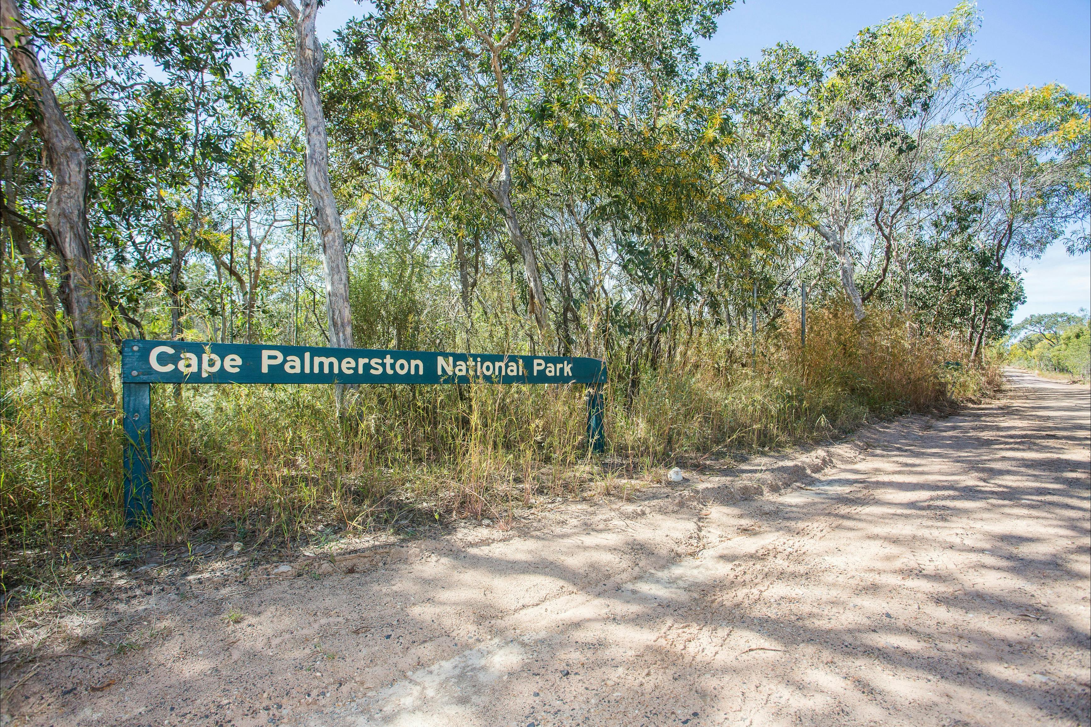
Sarina to Cape Palmerston National Park
From Mackay, head south on the Bruce Highway, passing through the charming townships of Sarina, Koumala, and Ilbilbie on your way to Cape Palmerston National Park. Turn off the Bruce Highway at Ilbilbie and head east towards Greenhill. Just before reaching Greenhill, take a left onto Cape Palmerston Road.
The township of Greenhill is easily accessible via Greenhill Road, with convenient beach access from the Esplanade. However, if you plan to explore deeper into Cape Palmerston National Park, a four-wheel drive is recommended, along with sufficient supplies to ensure self-sufficiency during your adventure
Cape Palmerston National Park to Cape Creek Camping Area
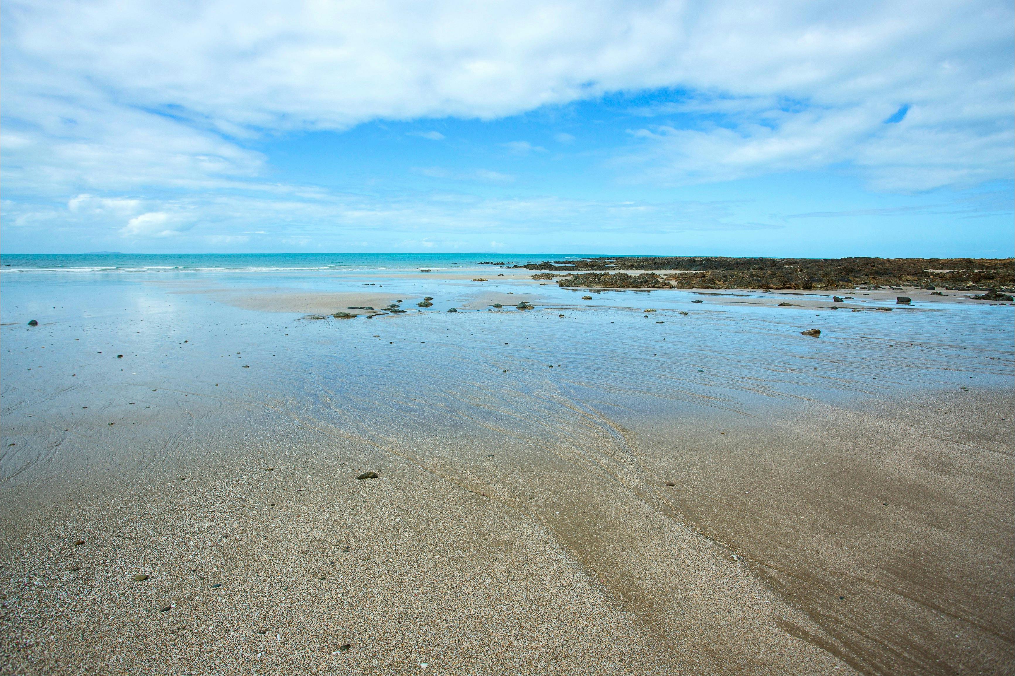
Once you cross into the breath taking Cape Palmerston National Park, get ready for an unforgettable adventure. Heading to Windmill Bay? Prepare for a scenic journey! Allow about an hour to wind your way along the pristine beach, leading you to this tranquil camping spot nestled in the park’s northern reaches. Picture the golden sands meeting turquoise waters—a camper’s paradise!
For those looking to discover the charm of Cape Creek, take a detour inland along a rugged track heading west. This path will guide you to a serene sandy spit, home to the Cape Creek camping area and boat ramp. It’s the perfect spot to set up camp, launch a boat, or simply soak in the peaceful surroundings of this secluded haven.
Whether you’re after coastal vistas or quiet Creekside escapes, Cape Palmerston is waiting to amaze you at every turn. Adventure awaits—start exploring!
Cape Creek to Mount Funnel
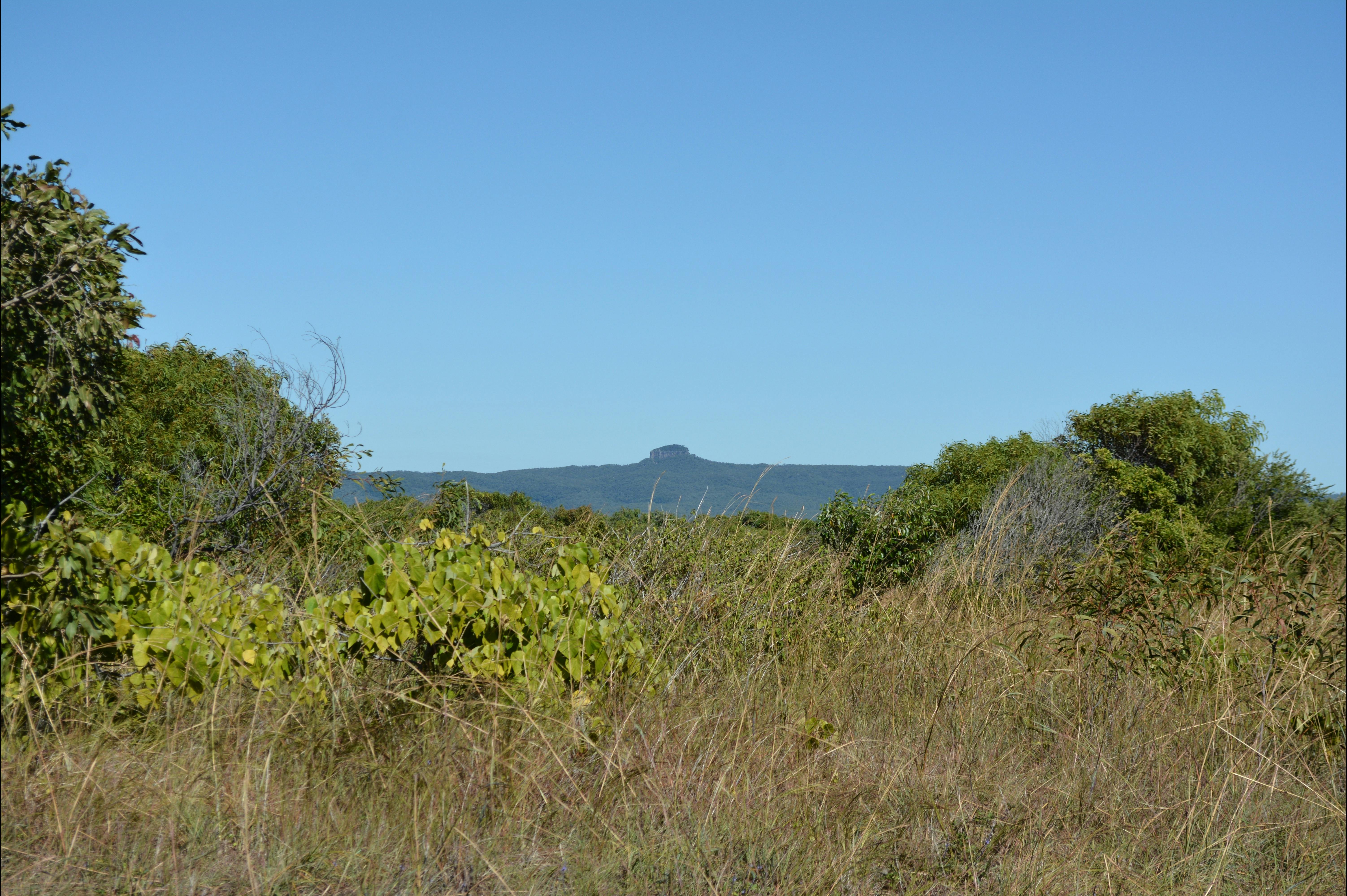
From your camping area (Windmill Bay or Cape Creek) you can see the wonderful landscape view featuring Mount Funnel, rising 344 metres above sea level, with a distinctive volcanic cap. Experienced climbers can climb the base, with a circumnavigation providing exquisite views across the Cape. There is no defined walking track, so climbers must take extra care, but the view from the top is well worth it.
Head back to Cape Creek to set up for the night.
Cape Creek to Cape Palmerston National Park
Drop a fishing line and relax amongst the serenity. Dense mangroves line the many branches of Cape Creek, but be aware of your surroundings at all times to keep an eye out for crocodiles, which can inhabit the area! Bream, flathead and cod are commonly caught within the inland system of the creek.
Set up camp and watch and listen as the park’s native evening fauna go about their night time business.
Cape Palmerston National Park to Windmill Bay
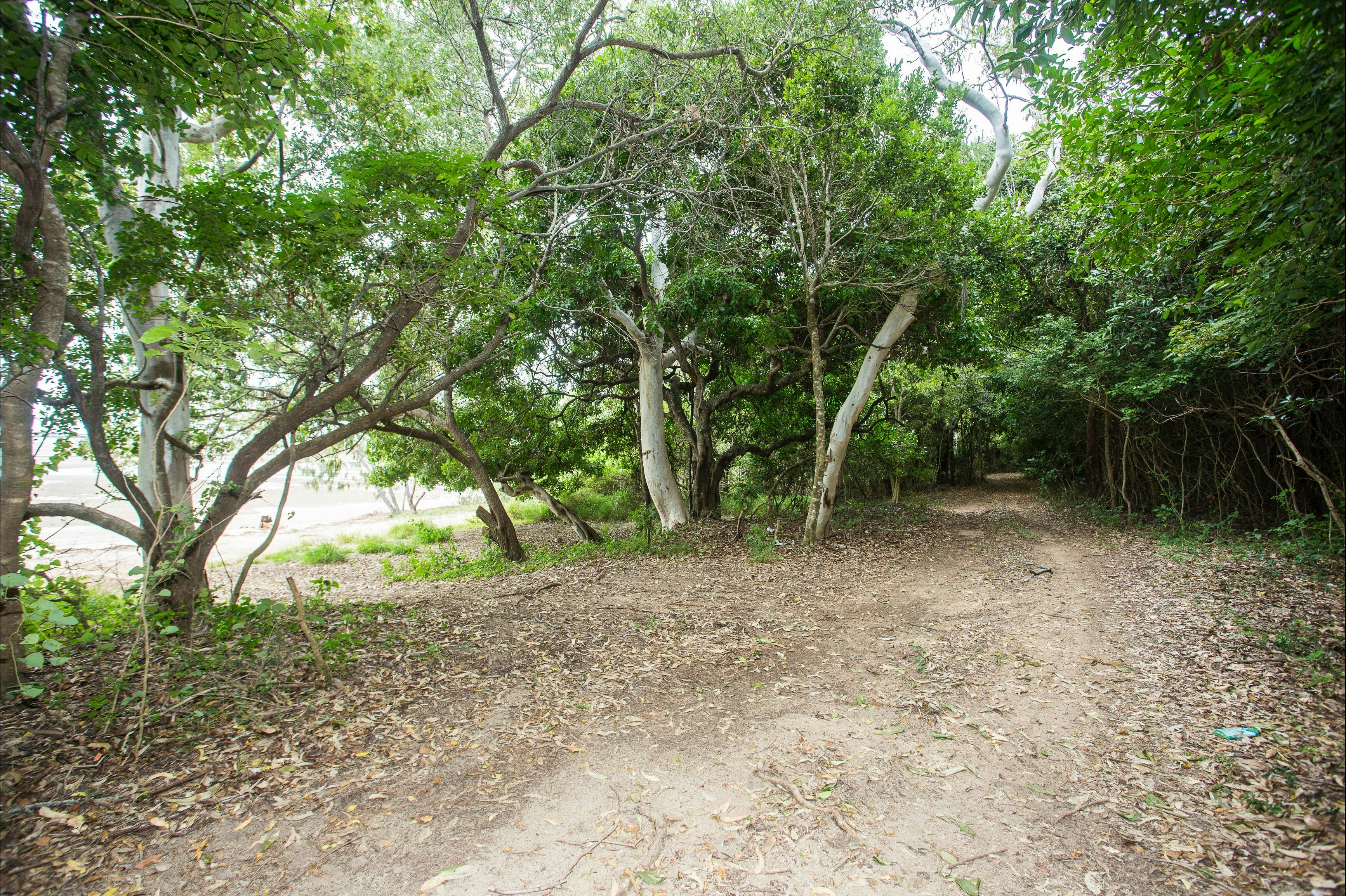
Explore the heart of Cape Palmerston National Park. See open eucalypt woodland with ironbark and poplar gum on the ridges, while dense rainforest, mangroves and gullies of paperbark grow towards the coastline! As the canopy clears, the vision changes to sand dunes, soft-sand beaches and rocky headlands.
Head back to Windmill Bay, fronted by a sandy beach and shaded by she-oaks. Explore the surrounding landscape to see traces of shell middens created by Aboriginal inhabitants of the past and find the windmill hidden in the bush, which inspired the name for the area.
Follow the track along the coastline to the cape itself, where a walk to the cliff tops will reward you with views out toward Northumberland Islands National Park.
Look into the water below for the chance to spot a dugong, turtle or passing whales during migration season! You may also see ospreys and sea eagles soaring overhead.
Set up camp at Windmill Bay or find nearby accommodation located close to Greenhill or Ilbilbie. Evening strolls from a nearby camping ground to the beach will give you the chance to see the fascinating fireflies that inhabit the local area!
Windmill Bay to Finch Hatton Gorge
Begin the day by travelling back towards Mackay on the Bruce Highway. After passing through Sarina, look for Homebush Road, located between Sandy Creek and Bakers Creek. At the end of Homebush Road, turn right onto the Peak Downs Highway and then left onto Victoria Street, which becomes Mirani-Eton Road.
Continue your journey into the Pioneer Valley, stopping for a famous Pinnacle pie or crumbed steak at the pub in Pinnacle, amongst the canefields. After a spot to eat continue along Mackay-Eungella Road in the Pioneer Valley to Finch Hatton Gorge.
Finch Hatton Gorge to Finch Hatton
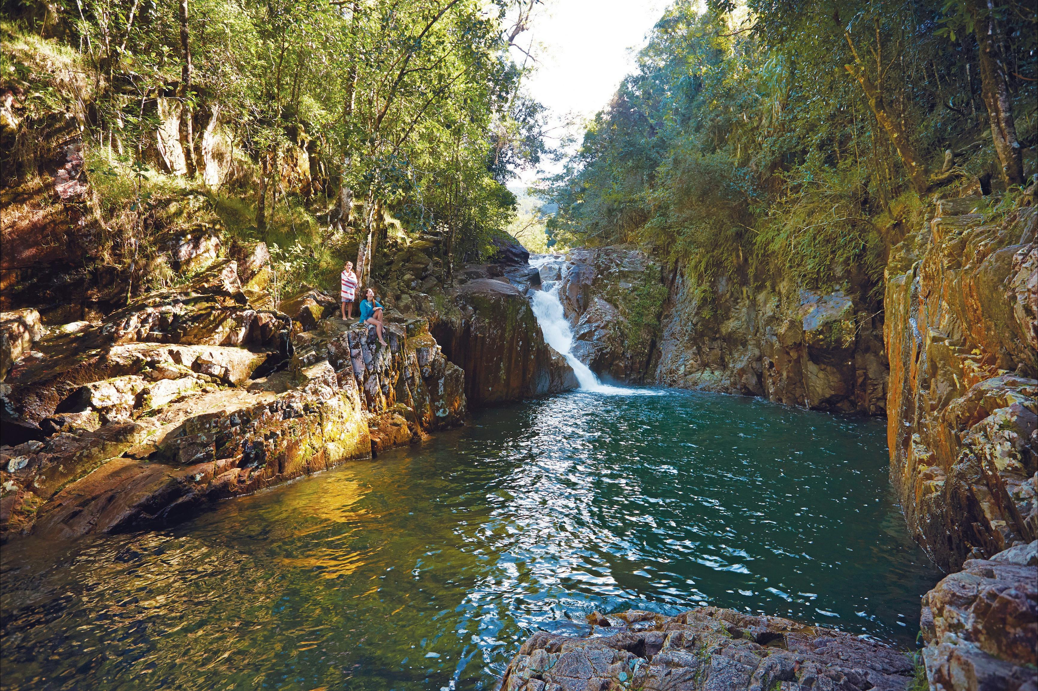
A wonderland of waterfalls, lush flora and volcanic boulder formations contrast against a tapestry of sugar cane fields as you arrive in Finch Hatton Gorge!
Walk one of many tracks which wind into the verdant subtropical rainforest.
Search for rare and unusual flora and fauna such as the rare gastric brooding frog, the orange-sided skink, Mackay tulip oak, Eungella spiny cray and Eungella honeyeater.
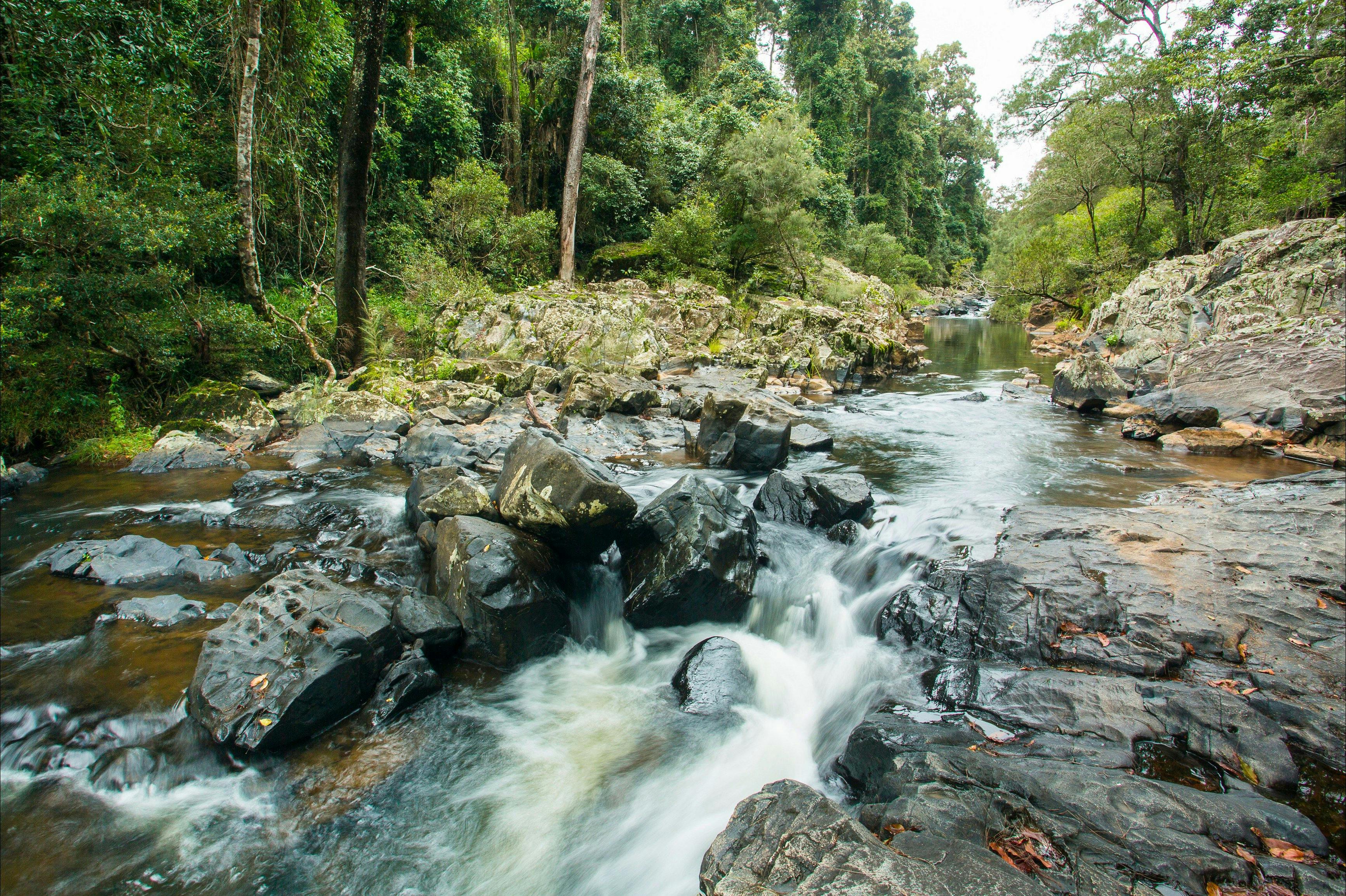
Take a refreshing swim in one of many clear rock pools found in the rainforest, as water cascades over and around larger boulders upstream!
Walk the well-formed track to Araluen Cascades and enjoy a tranquil picnic. Continue through lush rainforest and between great granite boulders to the lookout above the Wheel of Fire Waterfall! This walk does include a number of stairs, but the view is well worth the effort.
Get to know the locals at Finch Hatton and experience genuine Australian bush hospitality for the evening.
Take in the sights, smells and sounds of this natural paradise amongst the canopy of the rainforest on zipline adventure. Experience the rainforst canopy 25 metres above the ground.
Enjoy a freshly prepared meal amongst the greenery in a Finch Hatton cafe.
Finch Hatton to Eungella
From Finch Hatton, start the drive to Eungella and view the changing vista of the Pioneer Valley at sunset while enjoying a superbly cooked meal.
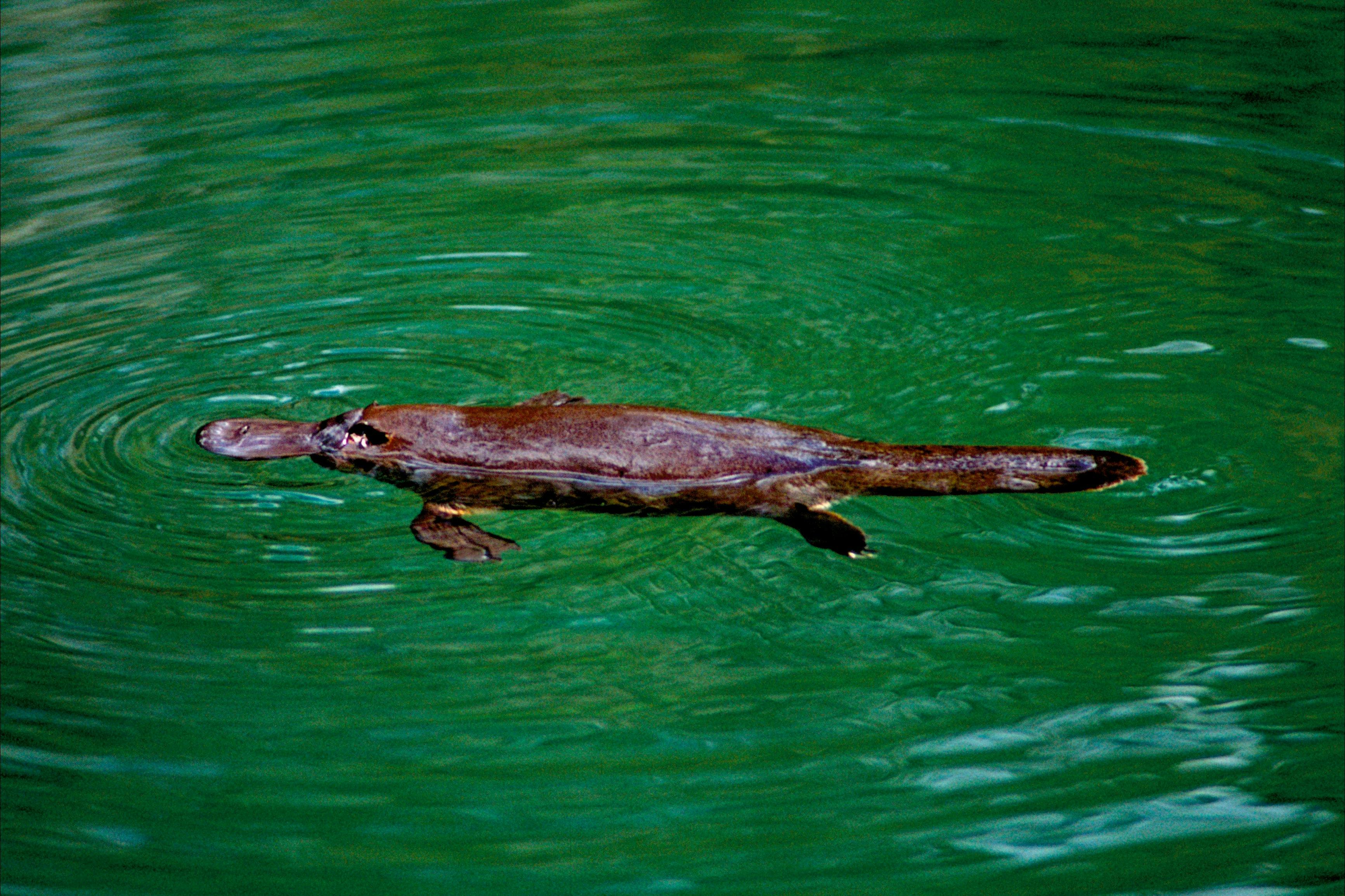
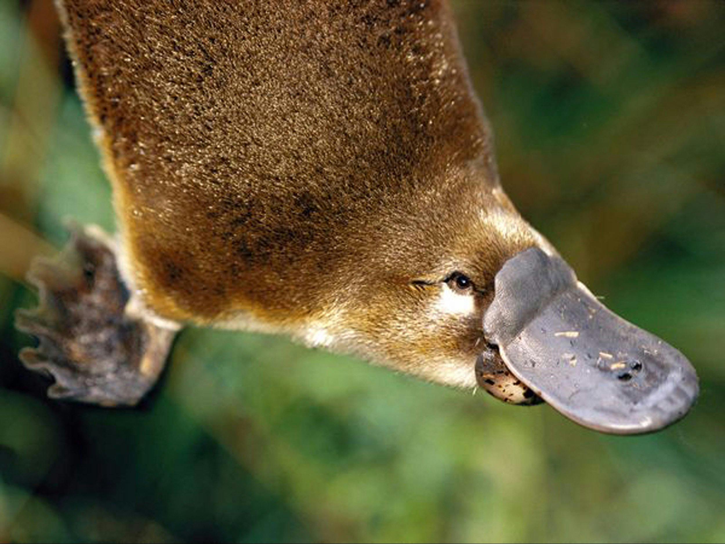
Wake early and venture to the Broken River trail to the viewing platform for the chance to see the playful platypus swimming in its natural environment! Eels and turtles also can be regularly seen here.
There are number of walks for all levels of fitness including some walks with disabled access. There is over 20km of short walks for you to explore.
The Sky Window walk will lead you through layers of bright palms, with dewy fronds which glisten in the morning light for a spectacular view across the Pioneer Valley. Keep an eye out for signs along the way which give an insight into Aboriginal culture from earlier Eungella days.
For the experienced climber, the 56km Mackay Great Highlands Walk can be accessed here, where dramatic cliffs, rugged peaks, spires and sensational highland views can be experienced.
After a morning of bush walking and platypus spotting, enjoy lunch at a local cafe or restaurant, overlooking the dense sub-tropical rainforest and peaks of the Pioneer Valley, which are often shrouded in mist.
Eungella to Eungella Dam
Travel to the tranquil water of Eungella Dam and cast a line in the hope of catching barramundi or sooty grunter. Watch for a colourful array of birds and butterflies who call Eungella home, including blue-faced honeyeaters and rainbow lorikeets!
Immerse yourself in the serenity of a Eungella sunset and dine under the stars! Eungella comes alive at night. Go spotlighting to see gliders, tawny frogmouths and possums, before enjoying another night in the placid rainforest.
Eungella Dam to Cape Hillsborough National Park
Drive back to Mackay via Mackay Eungella Road until back on the Bruce High to head towards Cape Hillsborough National Park, where rugged, rainforest hills plunge to rocky headlands of rhyolite boulders, separating divine beaches.
Along your journey, enjoy morning tea amongst lush tropical gardens at the relocated Marian Train Station, now a teahouse popular for delicious home-style baking.
Known as the youngest volcanic area in Australia, Cape Hillsborough is an exciting place to explore by foot. A number of well-formed walking tracks lead you throughout the park, where you can view the dramatic rhyolite rock and cave formations that border both ends of Casuarina Bay!
Cape Hillsborough National Park to Casuarina Beach
As the tide falls, walk the exposed low tide causeway to Wedge Island and enjoy the serenity of Wedge Island beach. Be sure to cross the causeway before the tide comes back in, otherwise bring your own kayak to come and go from the island as you please. Orchid rock is ablaze with colour in late September when the golden orchids bloom, a photographers dream location.
Orchid Rock and Wedge Island provide secluded locations to enjoy swimming and snorkelling. Soft corals, crustaceans and a kaleidoscope of fish can be observed.
Throughout the summer you may be fortunate enough to encounter turtles laying their eggs on the beach, or their hatchlings heading to the water.
Settle into your beachside accommodation for the evening and enjoy the bush turkeys as they wander the area during sunset.
Casuarina Beach to Cape Hillsborough National Park
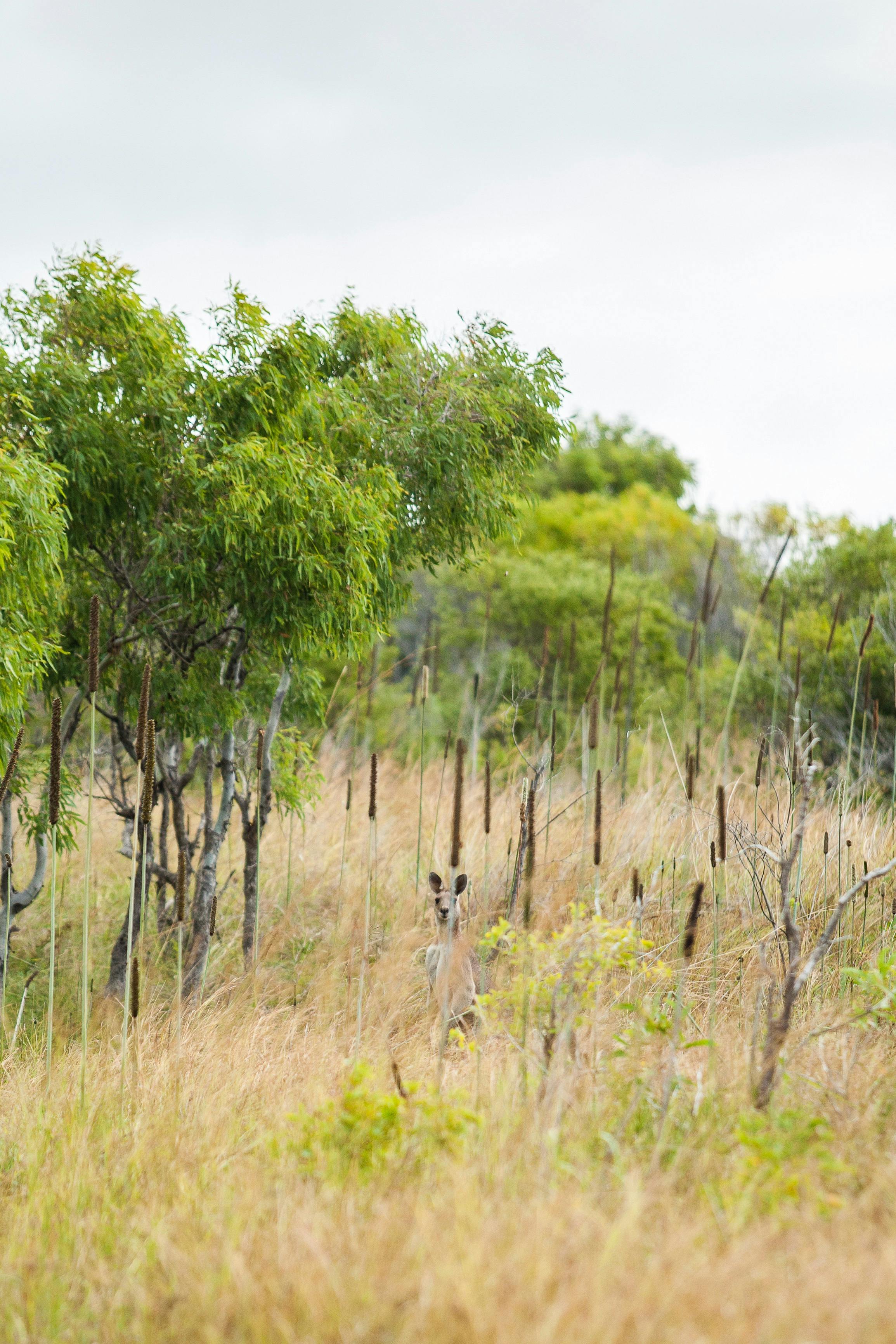
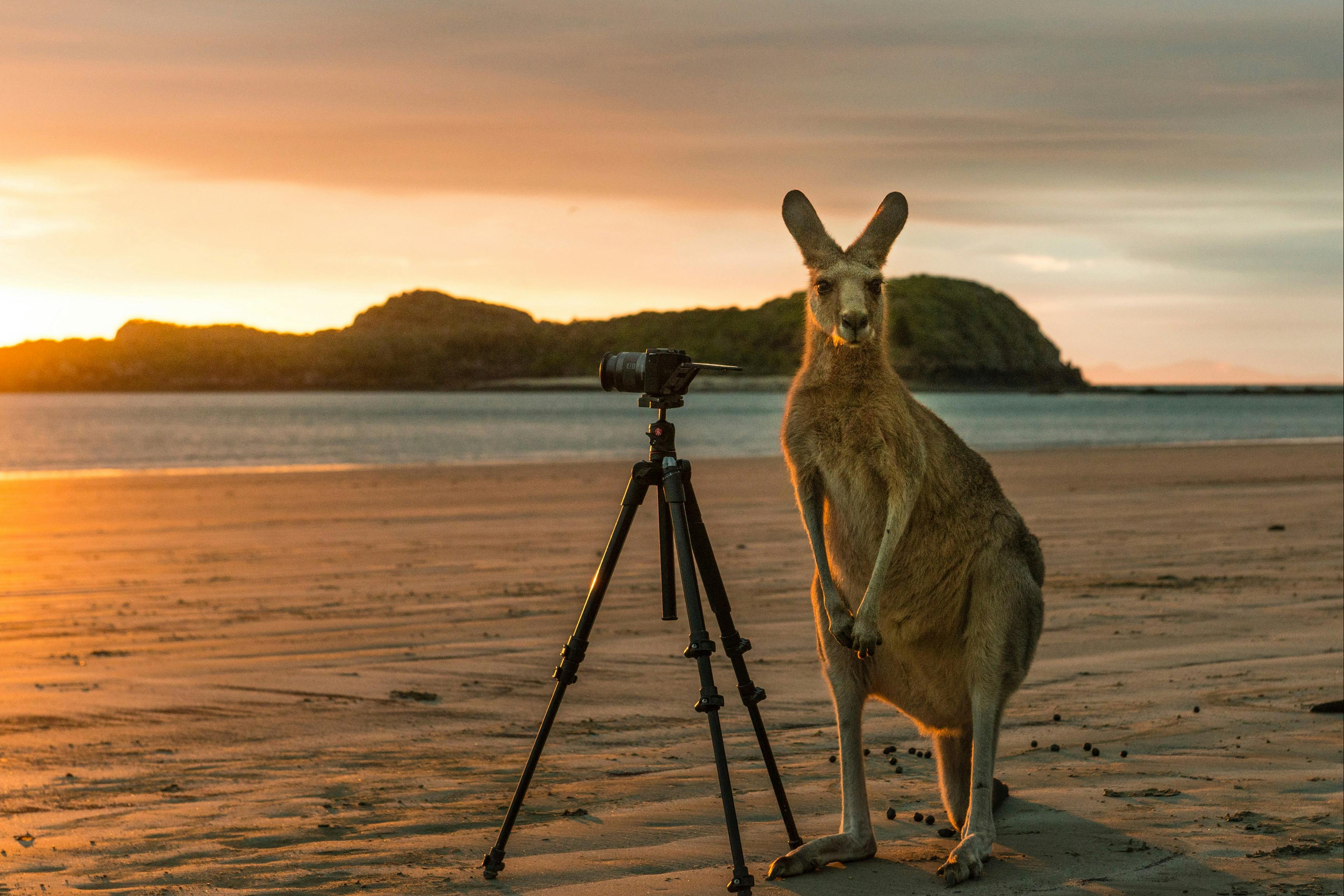
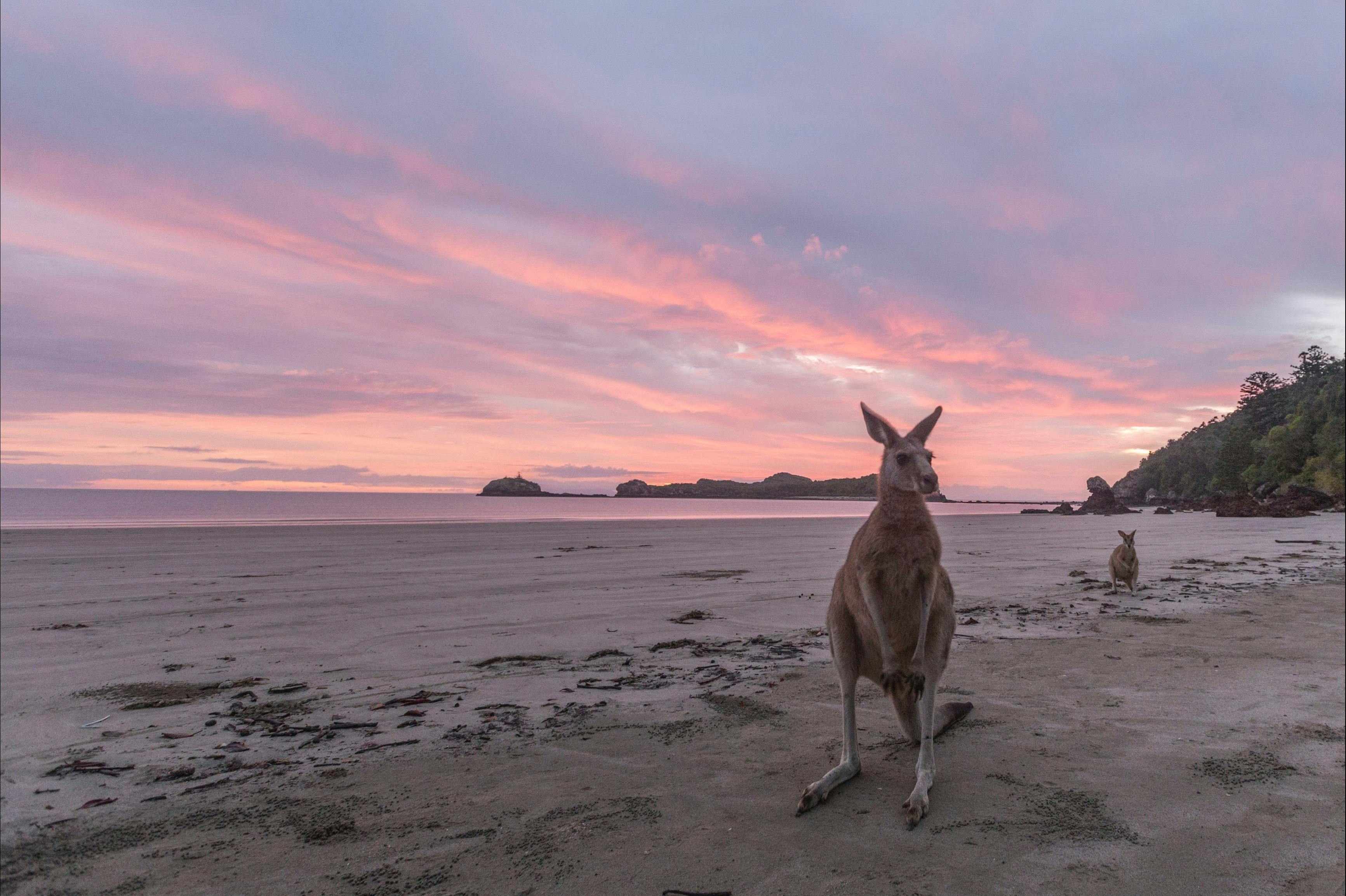
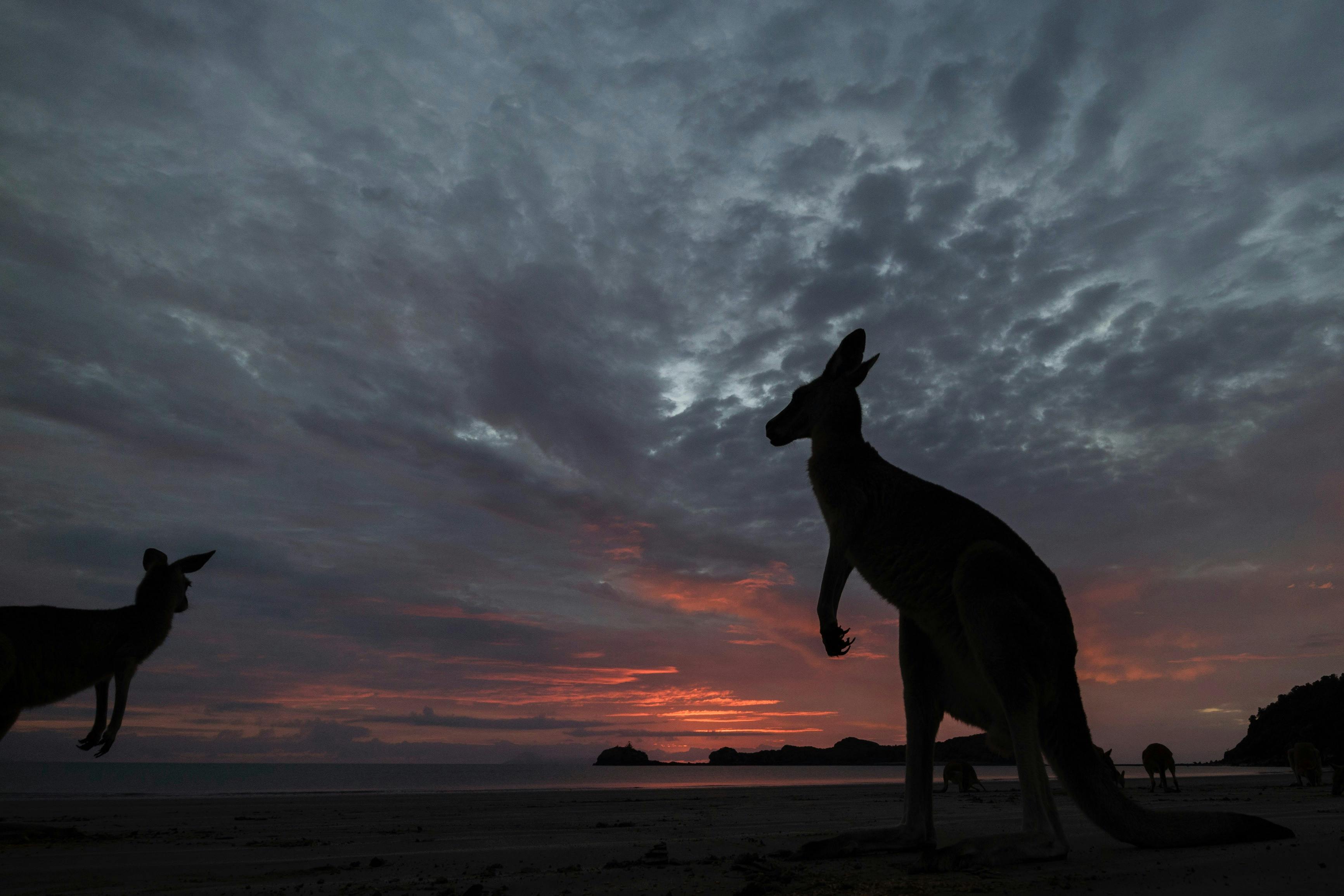
Wake early to view unique Australian phenomenon and be sure to bring your camera. Before the sun rises, stroll down to Casuarina Beach to view the spectacular sunrise behind the Wedge Island causeway. More often than not, wallabies and sometimes kangaroos will be hopping along the beach, fossicking in the tide for their seaside breakfast. This provides a unique opportunity to capture a wallaby, the sunrise and a beautiful Australian beach together in in one photograph.
San bubbler crabs leave intricate patterns at low tide and many other sea creatures shelter in tidal rock pools.
Meander through Melaleuca Woodland, a mangrove community, eucalypt open forest and vine thicket along the Diversity Boardwalk. Keep a look out for the Aboriginal middens. Discover the 1.6km Juipera Plants Trail for a fascinating insight into local Aboriginal history and then climb the headland on the Andrew’s Point walk for sensational views toward the Whitsunday Islands.
Cape Hillsborough to Mackay
Return to Cape Hillsborough and either cast a line at Sandy Bay, or simply enjoy the serenity strolling along the beach or just relax on the coast line as the waves lull you into deep relaxation fills you full of tranquility.
Spend another evening at Cape Hillsborough under a twilight sky full of stars, or head back towards the Bruce Highway and spend the night in the City Mackay.
Plan more around this area
 Andergrove, QLD
Mackay Caravan Park
Set on 21 acres of tropical paradise with clean tidy amenities, large van sites, lovely self-contained villas and cabins.
 Mackay Harbour, QLD
Discovery Parks – Mackay
A a tropical oasis dotted just two kilometres from the Mackay Marina precinct and central business district.
 Andergrove, QLD
 Mackay Adventure Lodge
Mackay Adventure Lodge was built with laidback yet refined outdoor living in mind, perfect for guests from all walks of life.
 Mackay Harbour, QLD
Mantra Mackay
Located on the relaxing waterfront setting of the picturesque Mackay Marina, Mantra Mackay is only a short drive from the city centre.
 Mackay, QLD
 Mycow Accommodation Mackay
Relax and enjoy the peace and comfort of your own private room or water front caravan site.
 Blacks Beach, QLD
Comfort Resort Blue Pacific
Enjoy a restful and tranquil atmosphere at this fully self-contained beachfront resort on Mackay's beautiful Northern beaches at Comfort Resort Blue Pacific.
 Mackay, QLD
 Moss on Wood
Moss on Wood is a modern twist on city styling, with a fresh hint of urban chic.
 Mackay, QLD
 The Dispensary Mackay
Whether you’re after a morning coffee, breakfast, long lunch or delicious dinner, they’ve got you covered.
 Mackay, QLD
 The Bavarian Mackay
Enjoy good food, good beers, good times, and the best of both worlds at The Bavarian.
 West Mackay, QLD
 Shamrock Hotel Mackay
The new Shamrock Hotel is the place in Mackay to dine out and catch up with great friends for any occasion.
 Mackay, QLD
 Botanic Garden Cafe
The Botanic Gardens Cafe is a great spot to stop for a coffee, breakfast or lunch with a stunning view of the lagoon and parkland.
 Mackay, QLD
 Buddy Boy Kitchen Mackay
At Buddy Boy Kitchen Mackay, the focus is all about bringing joy to the dining experience.