Chauvel's Border Light Horse Trail
Highlights
- Explore commemorative monuments along the Chauvel Border Light Horse Trail, honouring the sacrifices of the Australian Light Horse.
- Download a digital map or use Google Maps to navigate the captivating trail from Shepparton to Wagga Wagga.
- Discover detailed descriptions at each monument, enriching your understanding of history and its significance.
- Wander through the high country, soaking in the stunning landscapes that frame this historical journey.
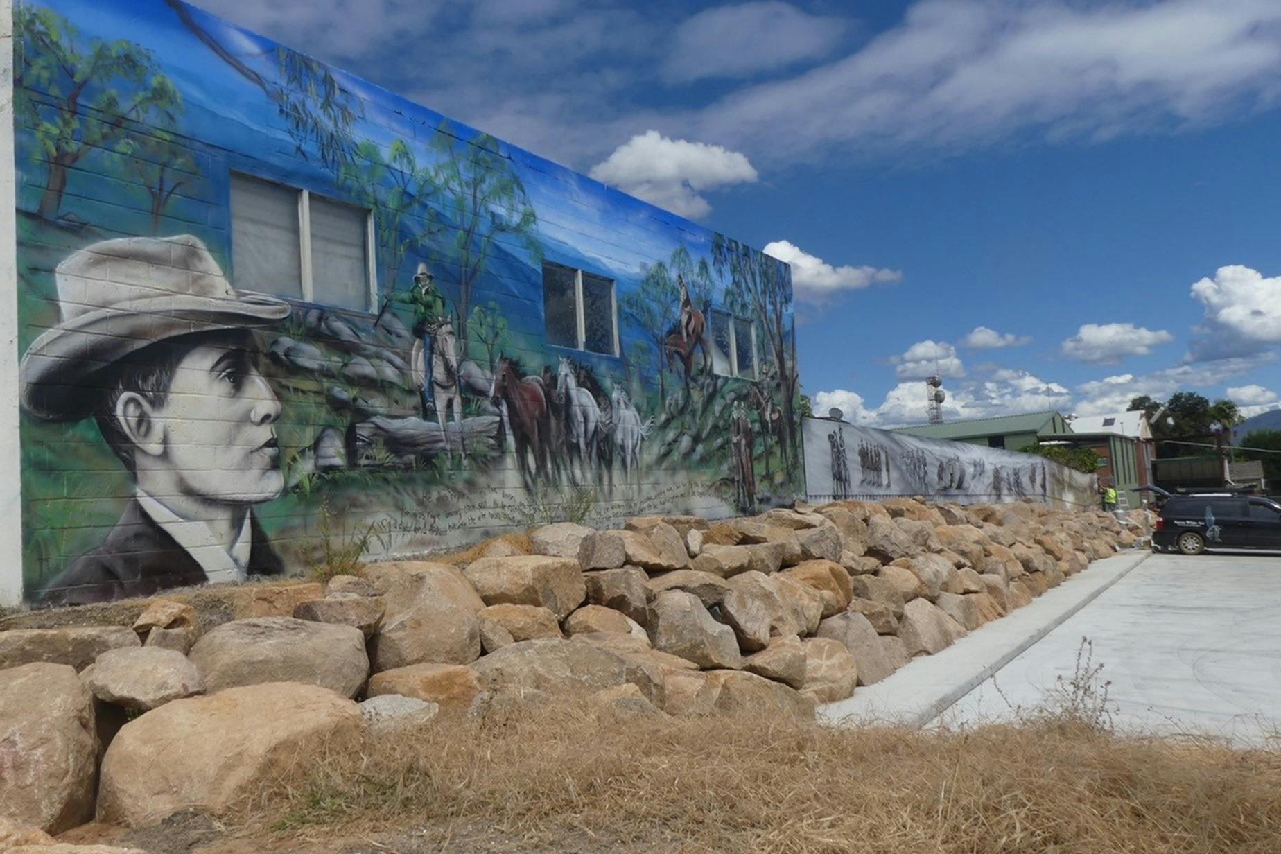
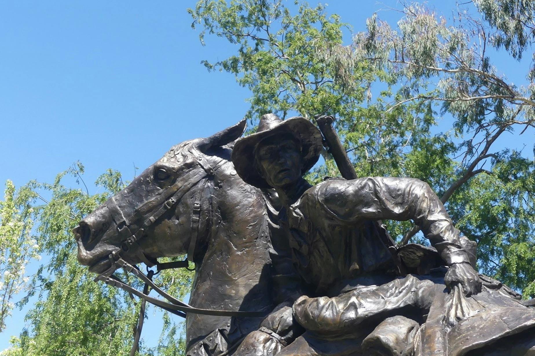
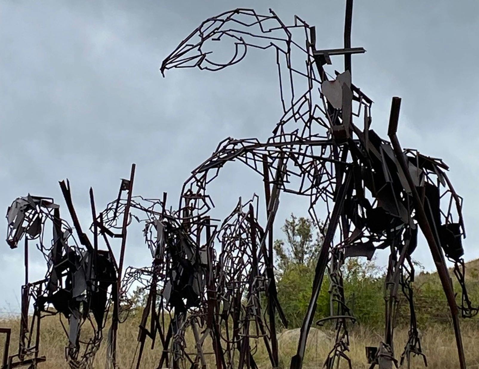
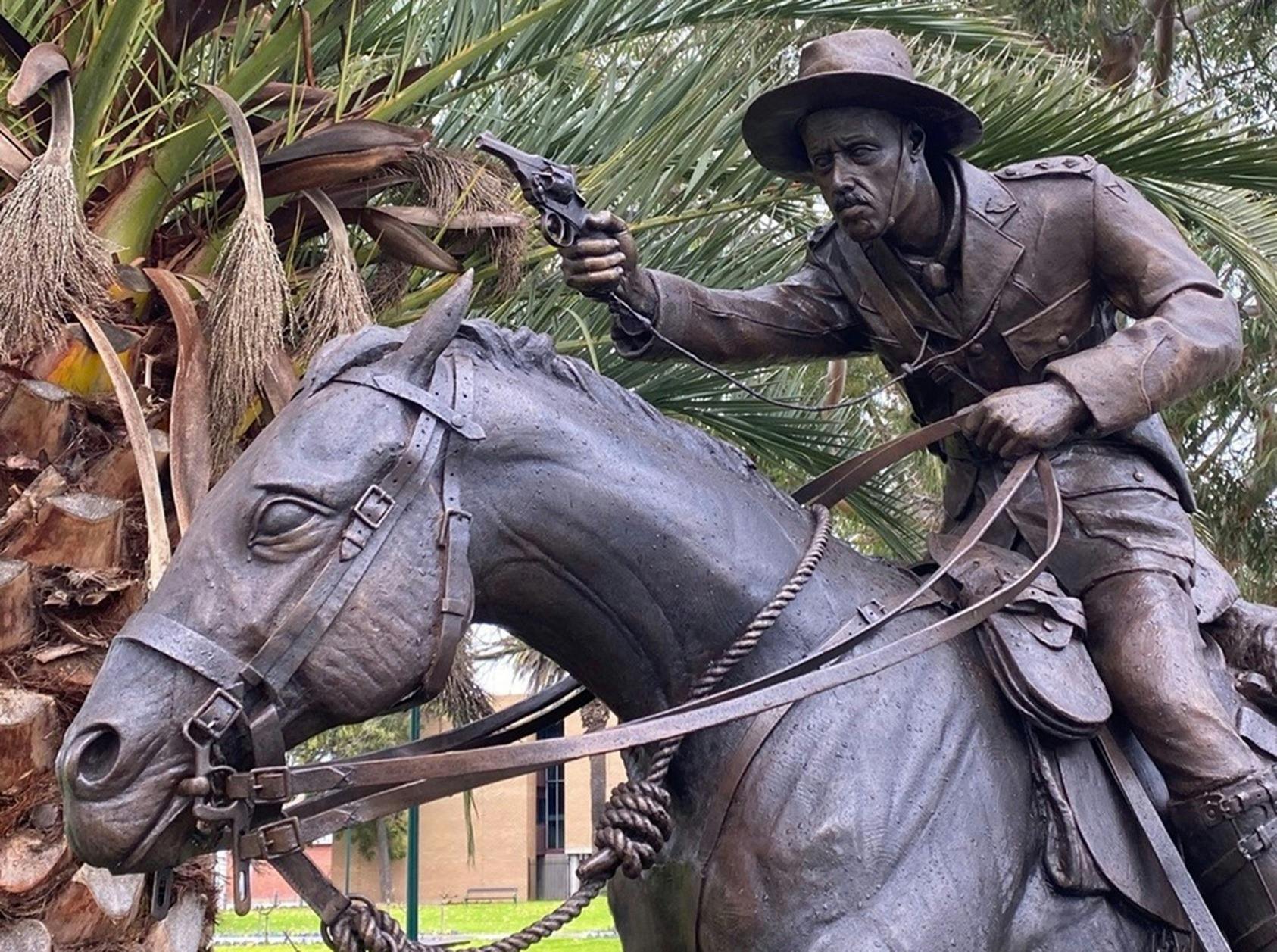
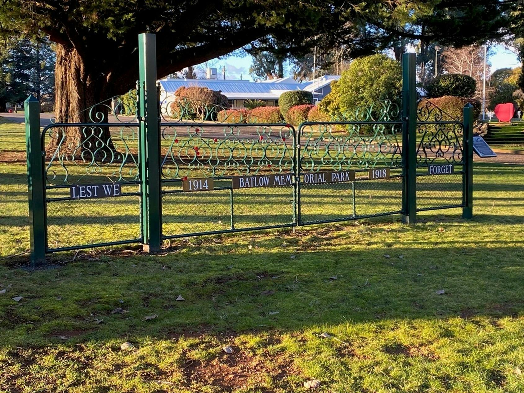
The Chauvel Border Light Horse Trail has been developed to allow Australians to explore the commemorative monuments and artwork that acknowledge the contribution and sacrifices of the Australian Light Horse from the Boer War through to World War Two.
The trail traverses the New South Wales-Victorian border and spans from Shepparton in the south, through the high country and across to Wagga Wagga. There is a physical printed map as well as a digital version that can be downloaded. The trail is also visible on Google Maps.
Each monument (or artwork) has a detailed description for the visitor to provide context and a background story.
Images and Video

This business does not currently offer accessible facilities.
Plan more around this area
 Corryong, VIC
 Milton Boutique Accommodation
The Milton Boutique Accommodation is located in the historic town of Corryong, featuring stylish and modern apartments.
 Corryong, VIC
 Poppy's Short Stay Accommodation
Poppy's is a luxury short stay accommodation, set in a premier location within a quiet street in the heart of Corryong, Victoria. This newly renovated
 Corryong, VIC
 Corryong Country Inn
Let your hosts spoil you with country hospitality while you are staying at the Corryong Country Inn. The well appointed ground floor motel units are
 Corryong, VIC
 Colac Colac Caravan Park
Colac Colac Caravan Park is located six kilometres from Corryong on the Murray Valley Highway.
 Towong, VIC
 Riverview Lodge
Riverview Lodge is a luxury bed and breakfast located in the beautiful Upper Murray Valley.
 Khancoban, NSW
 Alpine Inn, Khancoban
The Alpine Inn in Khancoban has recently reopened after a top to toe renovation of the resort. Featuring 36 immaculately renovated rooms.
 CORRYONG, VIC
 The Odd One Brewhouse Corryong
The Odd One Brewhouse is a fun and welcoming destination for both visitors to the Upper Murray and locals looking for something a little different.
 Khancoban, NSW
 Pickled Parrot Providore
The Pickled Parrot Providore features locally sourced fruit and veg and locally produced gourmet products.