Mount Roland
Highlights
- Explore the stunning 360-degree views from the summit, showcasing Bass Strait and Cradle Mountain.
- Hike the preferred track from Gowrie Park Village for a moderate incline and breathtaking scenery.
- Enjoy a picnic in the designated area, surrounded by the natural beauty of Mount Roland.
- Experience a variety of activities, including hiking and rock climbing, in the picturesque Kentish Municipality.
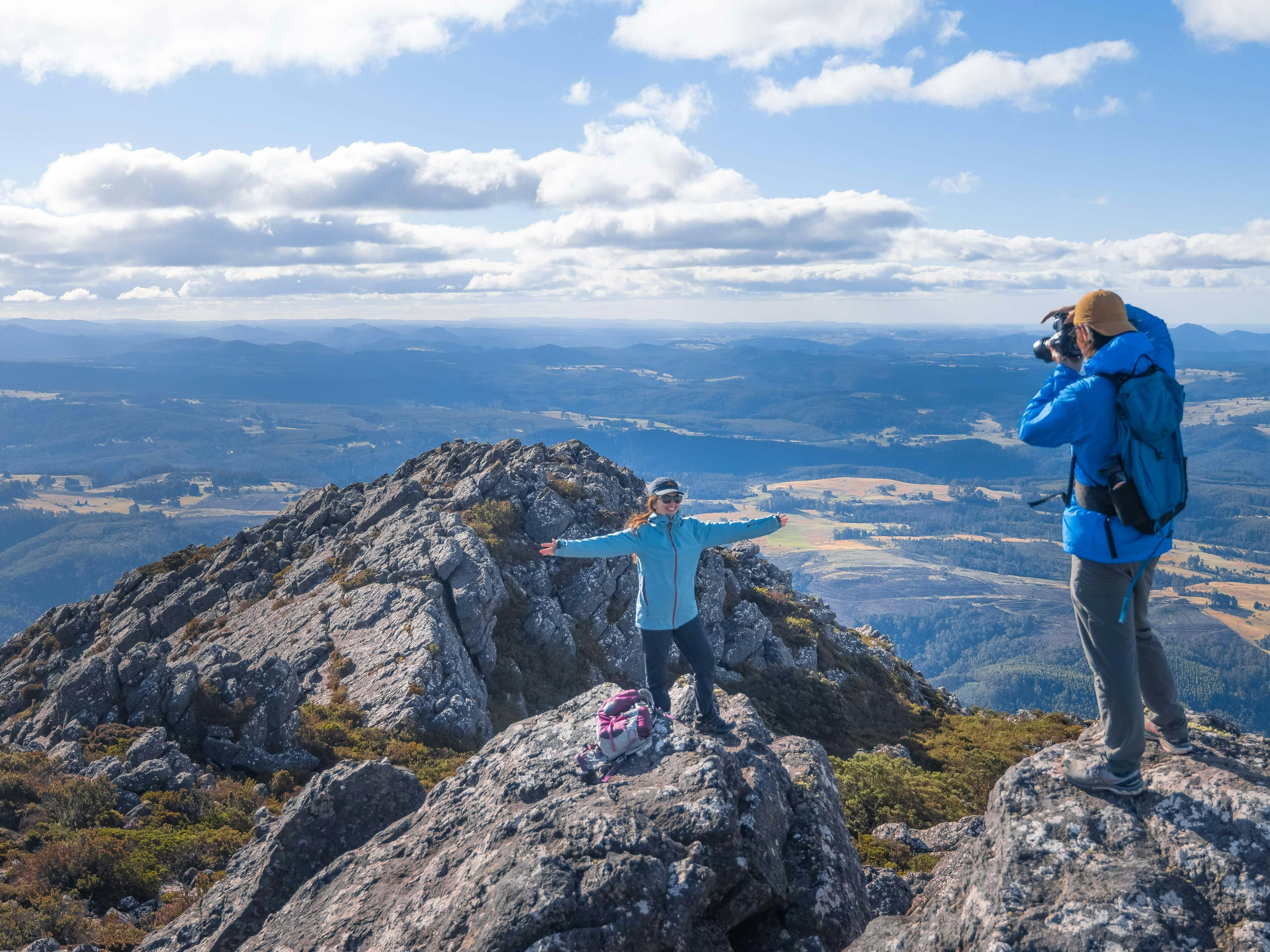
Mount Roland stands at 1233 metres above sea level and provides a stunning backdrop to the Kentish Municipality. The walk takes in the plains and plateau leading to the summit of the peak and there are two tracks to the summit.
The first – not recommended – the Mt Roland via Kings Road (Face Track), starts from Kings Road, Claude Road Village off the C136 and turns into a steep mountain climb. This track is not recommended as it is potentially dangerous, steep and awkward. Walking time takes from three to five hours return.
The second – and preferred – walking track starts at Gowrie Park Village on O’Neill’s Road off the C136 Walking time takes from four to six hours return. This is the easiest track to walk to the summit as it has a moderate incline.
The trig point at the top of the summit provides spectacular 360 degree views to Bass Strait, Cradle Mountain and Barn Bluff.
Images and Video

Accreditations
- TAS – Cradle Coast Authority
Features
Activities
Actively welcomes people with access needs.
Hearing
Caters for people who are deaf or have hearing loss.
Plan more around this area
 Railton, TAS
 CMCA RV Park Railton
For a relaxed stay in a grassed flat campground, look no further than Railton RV Park.
 Railton, TAS
 Railton Hotel
Only 23 minutes from Devonport, Railton Hotel is the ideal stopover when disembarking from the Spirit of Tasmania.
 Claude Road, TAS
Silver Ridge Retreat
Offering an indoor heated swimming pool, on-site trout fishing, quad biking adventures and an 1870's silver mine with stalactites, cave spiders and glow-worms.
 Lower Beulah, TAS
Minnow Cabins
Minnow Cabins, at Sheffield in northern Tasmania, offers self-contained accommodation in a bush setting.
 Wilmot, TAS
 Camping in the Paddock Wilmot
This is a hosted stay through Hipcamp, below is the information provided by the Host regarding their offering. Welcome to our peaceful place, where we
 Sheffield, TAS
AAA Granary Accommodation – The Last Resort
AAA Granary offers great value family accommodation only a 30-minute drive from magnificent Cradle Mountain.
 Sheffield, TAS
 Sheffield Hotel
Sheffield Hotel Tasmania is a charming rural pub-hotel nestled in the heart of Sheffield, Tasmania — famously known as the 'Town of Murals'.
 Sheffield, TAS
 Cradle Mountain Honey & Meadery
This 100% pure Tasmanian honey is a product of Sheffield Honey Farm. Sheffield is a town located in the beautiful area of North-Western Tasmania.
 Lower Barrington, TAS
 House of Hargrave
The House of Hargrave vineyard is located on a steep north-facing slope overlooking the Don Valley toward Bass Strait.
 Promised Land, TAS
 Crackpot Pop-Up Cafe
Crackpot Pop-Up Cafe is located at Tasmazia. Located on route to Cradle Mountain.
 Lower Wilmot, TAS
 Wilmot Hills Orchard & Distillery
I have a micro-distillery and cellar door. Open 6 days a week, closed Wednesday’s. We ferment, distil, and barrel-age on site.
 Aberdeen, TAS
Spreyton Cider Co
Spreyton Cider Co produces premium Tasmanian ciders made from apples grown in their orchards.