Southern Flinders Ranges Rail Trail
Highlights
- Discover stunning landscapes along the 80 km Southern Flinders Rail Trail, perfect for walkers and cyclists of all skill levels.
- Savour shaded stretches through lush vegetation, offering a refreshing escape in South Australia's picturesque countryside.
- Explore charming historical sites while enjoying convenient rest areas, making family outings both enjoyable and accessible.
Description
Short Description
Discover the stunning landscapes of the Southern Flinders Ranges on the Southern Flinders Rail Trail, a scenic route that follows the
Standard Description
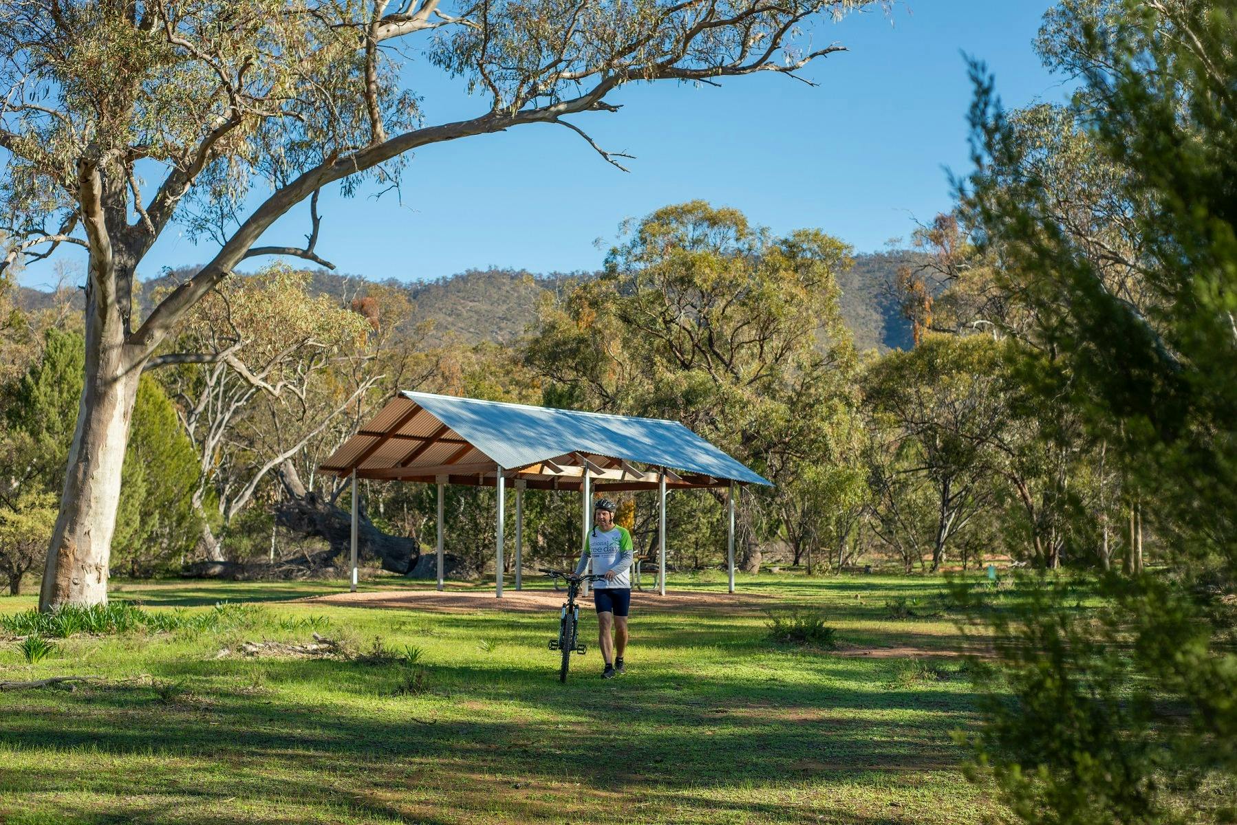
Discover the stunning landscapes of the Southern Flinders Ranges on the Southern Flinders Rail Trail, a scenic route that follows the former railway corridor from Laura to Wilmington, South Australia. This 80 km trail, split into six sections from 3km to 21km each, offers an ideal escape for walkers, cyclists, and nature lovers, showcasing the region’s rich agricultural history, native wildlife, and breathtaking views of the surrounding ranges.
The well-maintained, mostly flat trail is perfect for all skill levels, making it a great option for family outings or leisurely weekend adventures. Along the way, enjoy shaded stretches through lush vegetation, charming historical sites, and convenient rest areas. Whether you’re exploring the entire trail or enjoying shorter sections, the Southern Flinders Rail Trail provides an immersive way to experience the natural beauty of South Australia’s countryside.
Trail Details:
Distance: 80 km
Terrain: Coarse gravel, Fine gravel
Best suited for: Walking, cycling
Family-friendly with easy accessibility
Information sourced from railtrails.org.au
Images and Video
Contact and Booking Channels
Itineraries
Idlib Road to Laura (3 km)
This 3 km stretch of the trail runs alongside the Horrocks Highway and takes you right into Laura. While the official trail doesn’t run through the town itself, that just gives you a chance to wander through Laura’s charming main street before getting back on track!
The trail kicks off at the junction of Idlib Road and Horrocks Highway, just 3 km south of Laura. It’s a coarse gravel track, perfect for walkers and mountain bikers. As you approach Laura, follow these easy directions to find your way.
At the trail’s end, turn left, then right onto West Terrace. The road will change from gravel to sealed, and you’ll take the third turn on the right into Whyte Street, then left into Herbert Street, Laura’s main street. Stroll along, and when the dual lane ends, cut through North Laura Parklands, where you’ll find toilets, a playground, and BBQ spots.
From there, continue along Mill Street, take a left on Alexander Street, then a right back onto West Terrace. As the road turns to gravel again, cross Pine Creek, and follow it until the road turns. The Rail Trail starts up again just 50 meters ahead.
Laura and Stone Hut (10 km)
This 10 km stretch takes you on a peaceful ride alongside the Horrocks Highway and the scenic Rocky River. With a smooth, compacted gravel surface, it’s an easygoing trail that’s perfect for all types of bikes and riders, no matter your skill level.
The journey kicks off at the northern “Welcome to Laura” sign, and for the first few kilometres, you’ll even be riding along part of the famous Mawson Trail. The trail officially ends about 650m before you reach Stone Hut, but don’t worry—you can follow the verge along Horrocks Highway right up to the beloved Stone Hut Bakery (a perfect pit stop for a treat).
After you’ve had your fill at the bakery, hop back on your bike, and just 70m past the Bakery, turn left onto Dee Road. The trail picks up again 40m from the intersection, ready to guide you onward!
Stone Hut to Wirrabara (the Remarkable Rail Trail – 9 km)
This section is full of interesting sights and a great riding surface, though it’s best suited for mountain or hybrid bikes. As you set off, you’ll need to cross Horrocks Highway about 850m in—just keep an eye out for fast-moving traffic, and you’ll be fine.
A bit further along, where Horrocks Highway crosses the Rocky River, you’ll see the remains of the original rail bridge nearby. The approach to the bridge is a little steep, and it’s a one-way bridge, so take care.
Around 3.5 km into the ride, you’ll cross the highway again—watch for the trail signs (though they’re a bit tricky to spot). After 300m, the trail veers off from the highway. You’ll turn left onto Hollitts Road and then right to continue on the trail.
One of the more unique moments comes when you cross the Rocky River again—this time without a bridge. The trail drops down to the riverbed, where you’ll navigate over the old railway embankments. It’s not too tough, but if the water level’s high, it might be impassable.
As you near Wirrabara, the trail is lined with beautiful old pine trees, remnants of a forest planted back in 1877. The stretch through the pines is only about 300m, but it’s a lovely sight!
Once you hit Forest Road, turn left. You’ll spot the trail again a short way down on the right. If you’re up for a quick detour, continue along Forest Road to check out the local silo art before rejoining the trail. After crossing Rocky River again, you’ll come across Wongabirrie Park—a perfect spot for a break, with toilets, BBQ facilities, and even a caravan park.
From here, use the small footbridge to head toward Horrocks Highway, where you can visit the local bakery before continuing on your adventure. The next part of the trail picks up on the opposite side of Horrocks Highway, right after Kurrajong Street. Keep an eye out for the trail marker post to get back on track.
Wirrabara to Booleroo Centre (the Remarkable Rail Trail – 21 km)
This 21 km section offers a mix of gentle climbs and beautiful views, perfect for cyclists looking to enjoy the outdoors without too much strain. The first 25 km of the trail (from previous sections) have been nearly flat, and now the next 7 km is a gradual, steady climb—not too tough unless you catch a headwind. The trail’s fine compacted gravel surface is ideal for mountain or hybrid bikes.
Following Wirrabara-Appila Road, the trail veers north, heading toward the old rail siding at Yandiah. While there aren’t many remnants of the railway left, keep an eye out for quirky sights like an old freight carriage on stilts, now repurposed for farm storage, and a fence built from solid old railway gates.
After about 6.5 km, you’ll cross Mahood Road, marking the highest point of the trail. From here, it’s a gentle descent toward Yandiah, with sweeping views of the Appila Plains that make this part of the ride extra special.
Yandiah is a tiny, quiet spot that was established in 1874. Today, all that remains of its railway history is a small siding and a few sleepers. The railway, built in 1910, must have been a lifeline for this small community. You’ll find a plaque and a Station Board near the trail, offering a glimpse into the past.
As you head toward Booleroo Centre, the trail meanders along Pine Creek Road and Appila Road. You’ll pass over a few narrow stock grids, which are easy to cycle across if you slow down a little. It’s a pleasant, scenic ride all the way into Booleroo Centre, offering plenty of country charm along the way.
Booleroo Centre to Melrose (17 km)
This stunning 17 km stretch, completed in September 2021, offers a smooth ride along compacted fine gravel, following the old railway alignment through open farmland toward the imposing Mount Remarkable. With several creek crossings, it’s best suited to mountain bikers, but the adventure is worth it!
Start your journey in Booleroo Centre, where you can park near the historic railway display at the corner of Campbell and Arthur Streets. Grab supplies or use the public toilets on Stephens Street before hitting the trail. The trailhead is near the Town Swimming Pool, and from there, you’ll wind past grain sheds and silos before leaving town with Mount Remarkable always on the horizon.
Along the way, you’ll cross a few curved stock grates, so take it easy as they can be narrow. About 5 km in, you’ll come across the remnants of Perroomba Station, marked by a few old timber sleepers—a little piece of history on your ride!
The trail crosses four creeks, each with its own character:
Bastion East Creek – Watch out for the steep sides as you cross.
Bastion West Creek – The trail dips down into the creek bed here.
Collins Creek – Another creek bed crossing, with old concrete pylons from the original rail bridge adding a cool visual.
Rotten Creek – The largest of the crossings, this creek can have a steady flow after rains, making it a bit more exciting.
As you near Melrose, the trail follows Girdham Road toward Horrocks Highway, passing the silos before arriving at the Melrose Showgrounds. From here, you can either continue to Wilmington or take a left to head into the heart of Melrose, just 2 km away. Once in town, Paradise Square is a perfect spot to rest, grab a bite, and soak up the local atmosphere.
Melrose to Wilmington (20 km)
The Melrose to Wilmington section of the Remarkable Rail Trail spans 20 km and offers a delightful cycling experience along the old railway alignment. This well-maintained trail features a compacted fine gravel surface, making it best suited for mountain bikes. As you ride, you’ll be treated to stunning views of Mount Remarkable on one side and the Flinders Ranges on the other.
Starting at the corner of Joes Rd and Horrocks Highway, you can easily join the trail from the Melrose Showground entrance. The trail meanders through open fields, providing an enjoyable ride through picturesque landscapes. Along the way, you’ll cross Horrocks Highway and pass by historical landmarks, including the remnants of the old township of Terka, where only a chimney remains to tell its story.
One of the highlights of this section is crossing Stony Creek, where you’ll want to dismount and stroll across the rocky creek bed, soaking in the beautiful scenery. The trail continues to follow Gogler Rd, leading you into Wilmington, where you’ll find local amenities, including shops and cafes.
Remember to stay hydrated and bring enough supplies, as mobile phone coverage can be limited in this area. Overall, this section of the trail offers a perfect blend of nature, history, and adventure for all cycling enthusiasts.