Lavender Federation Walking Trail
Highlights
- Experience breathtaking 360-degree views from Mount Beevor, showcasing the stunning Mt Lofty Ranges and beyond.
- Traverse diverse landscapes from Murray River banks to historical towns, immersing in the region's rich culture and nature.
- Enjoy a variety of loop and spur trails, catering to all skill levels with easy access to nearby towns and facilities.
Description
Short Description
The Lavender Federation Trail is a linear walking trail of 167 kilometres through diverse countryside traversing the eastern flanks of the Mt Lofty Ranges.
Standard Description
The Lavender Federation Trail is a linear walking trail located between Murray Bridge, southeast of Adelaide, and Clare in the Mid North. The main trail is 325 kilometres, with connecting trails an additional 150 kilometres.
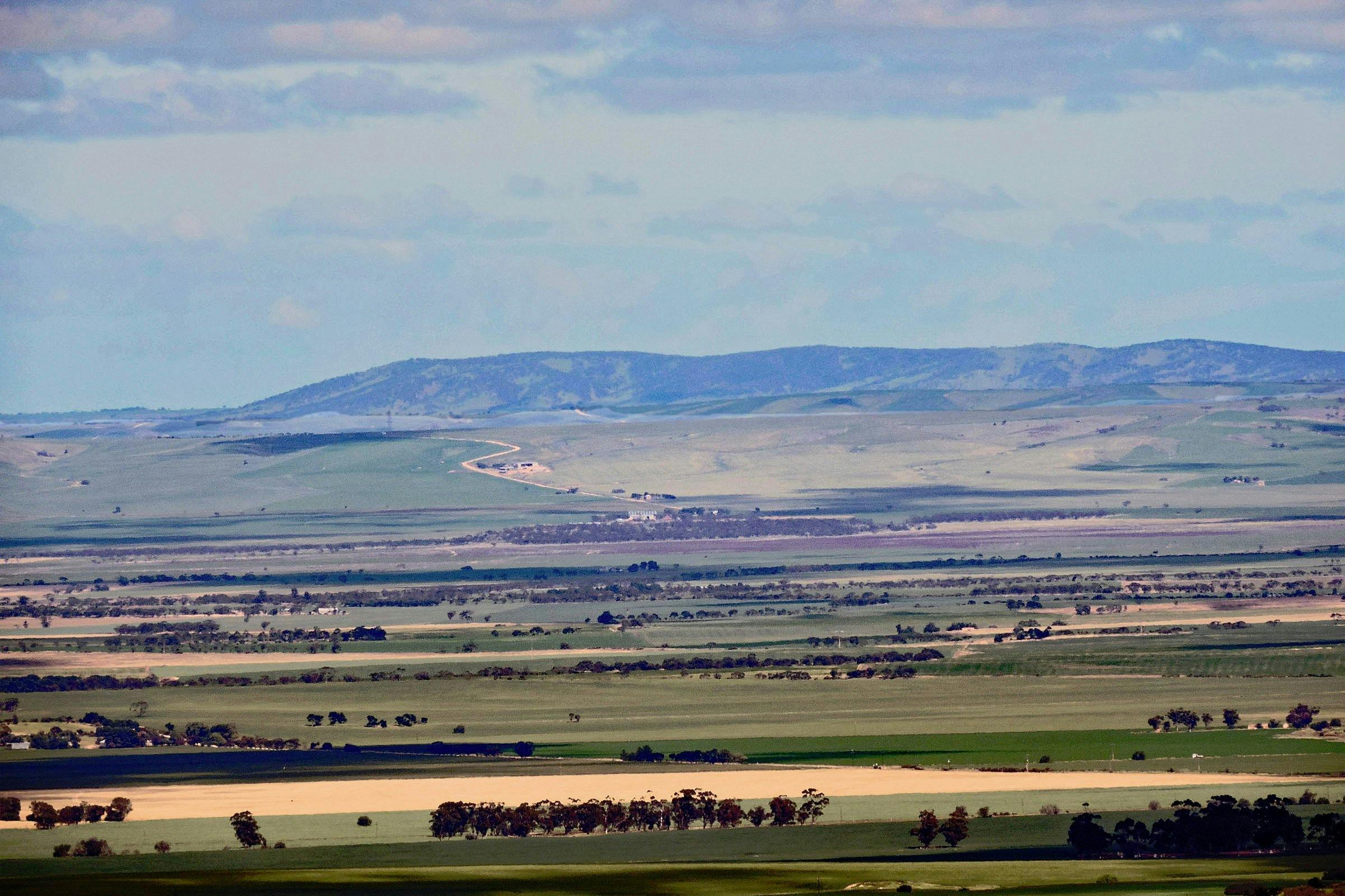
Starting at Murray Bridge, the trail initially travels along the banks of the Murray River before heading inland, following the eastern side of the Mt. Lofty Ranges through the Barossa and Mid North regions to Clare. The trail’s serpentine course takes it through gorges, vistas with 360-degree views, several wine regions and many historical areas and towns.
The Lavender Federation Trail intersects with the Murray Coorong, Kidman, Mawson, Heysen and Riesling Trails. Many loop trails (seven) provide easy access for walks ranging from 8 to 23 km, starting and ending at the same spot.
Spur trails (8) connect to the main trail to nearby towns and facilities.
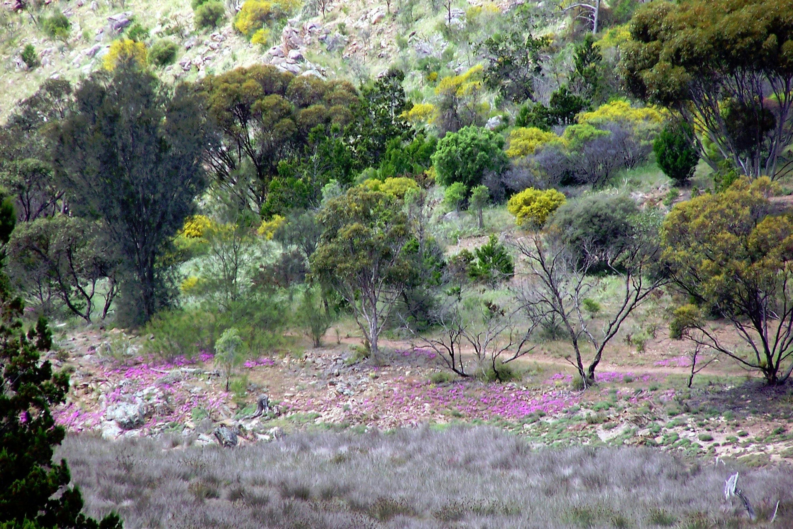
Some of the more spectacular sections are Rocky Gully, glimpses of exotic animals at Monarto Safari Park, 360 degree views from Mount Beevor (Mt. Lofty, Mt. Barker, Coorong, Southern Ocean, Murray River), gorges with permanent water near Dutton, wind turbines near Waterloo and glimpses of St Vincent Gulf from Spring Gully Conservation Park near Clare.
The Lavender Cycling Trail, a bike version of the walking trail, is designed for touring and e-bikes.
Images and Video
Contact and Booking Channels
- Address: 7A Prosperity Grove, Murray Bridge, South Australia, 5253, Australia
- Social: Facebook · X (Twitter)
Itineraries
Truro to Eudunda
Sturt Highway to Eudunda section is 55.6 km. There are long sections between access points of up to 15 km. It is recommended only experienced walkers undertake most of these sections. Be aware of some very exposed areas and some very steep climbs and descents.
Sturt Highway to Dutton, 15.1 km.
Take care. The Sturt Highway at the crossing point is a 110 kph speed limit.
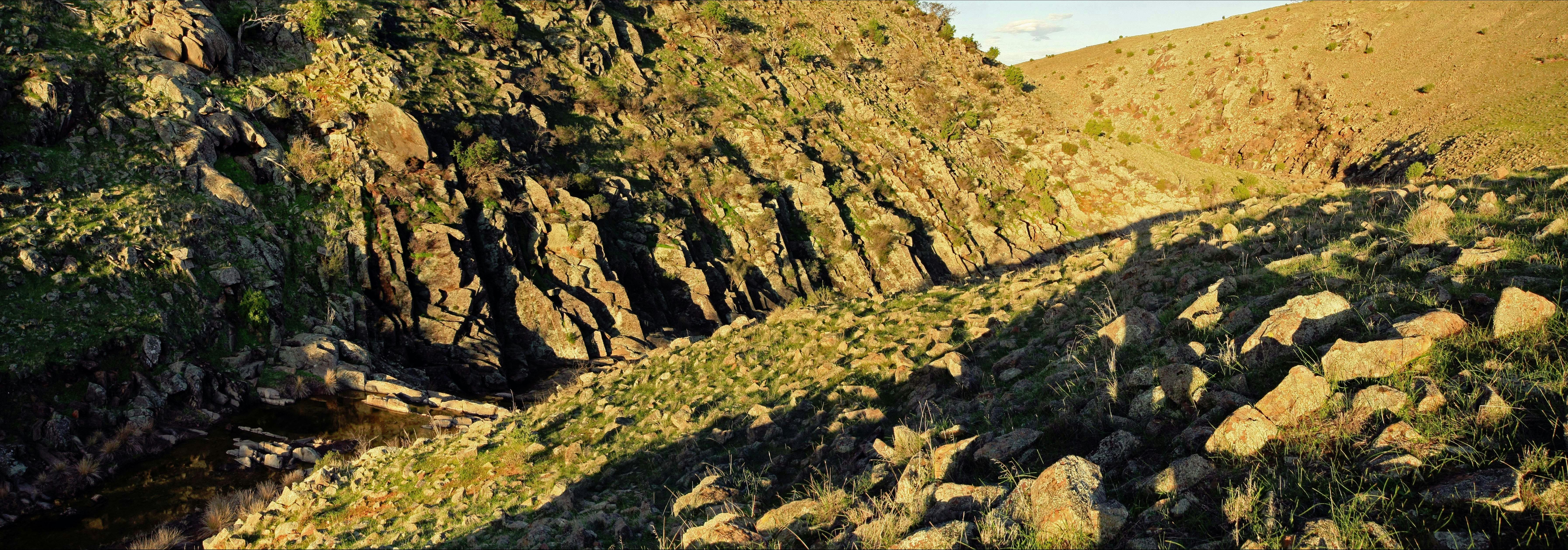
The trail takes a meandering route on road reserves and heads north on “Wild Dog Track”. Then, Waterfall Creek is crossed before heading west through “The Gap.” Almost unknown until the generosity of the local landowner made it accessible to walkers, this is a picturesque location with permanent water. Then follow Pine Creek and a minor road into Dutton.
Dutton to Leakes Pass Road. 14.3km.
From 6 occupied houses in the late 1940s, a population revival and restoration from the 1970s makes the Dutton Spur Trail a worthwhile diversion.
Leaving Dutton on secondary roads, the Truro to Eudunda Road is followed for 3 km before heading westward. Then, around the base of Mount Rufus before climbing to the summit of Leakes Lookout with 360-degree views.
A steep decent northwards, walk through grazing land, a wide deep creek into a wooded area and onto Leakes Pass Road.
Leakes Pass Road to Footeside Farm 12.2 km
Progressing northwards, a short section of road reserve connects to Smith Road providing a scenic route westward through Narcoota Springs, a watering place of early explorers and rare source of permanent water.
Climbing out of the reserve back onto Smith Road until leaving the road to climb an undulating path to follow the Truro- Eudunda Road to Footeside Farm.
Footeside Farm to Eudunda 14 km
Follow Foote Creek to Woithe Road noting the historic monument. Continue along Woithe Road to Von Reiben Road then cross the main road onto Nicholson Road, onto road reserves that then head towards Eudunda.
An aqueduct forms the route to the golf course, showground, oval and swimming pool. The final section follows the disused Eudunda to Morgan rail track into Eudunda.
Springton to Truro
This section of the trail is 49 kilometers but accessible from many towns adjacent to the trail. Loop and spur trails of varying lengths connect these towns to the main trail or can also be used as a separate walk starting & finishing at the same location.
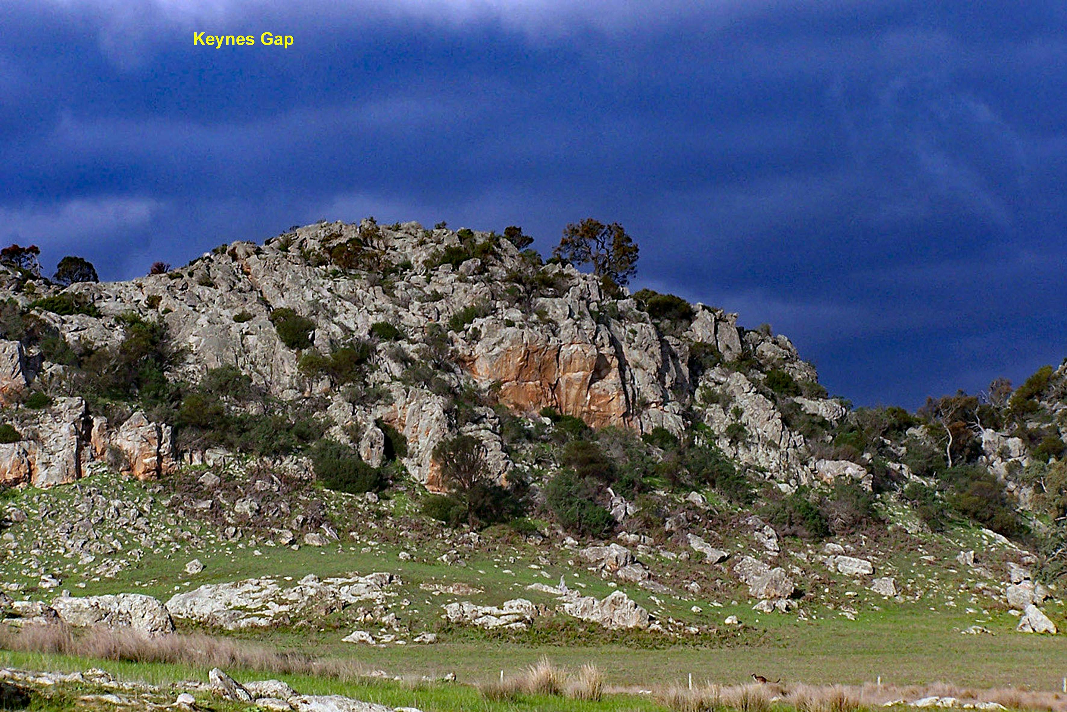
Springton to Keynes Gap, 11 kilometers.
The main trail is accessed using a section of the Springton Loop trail along Hamilton Road from the nearby Herbig Tree to the main trail on O Herbig Road.
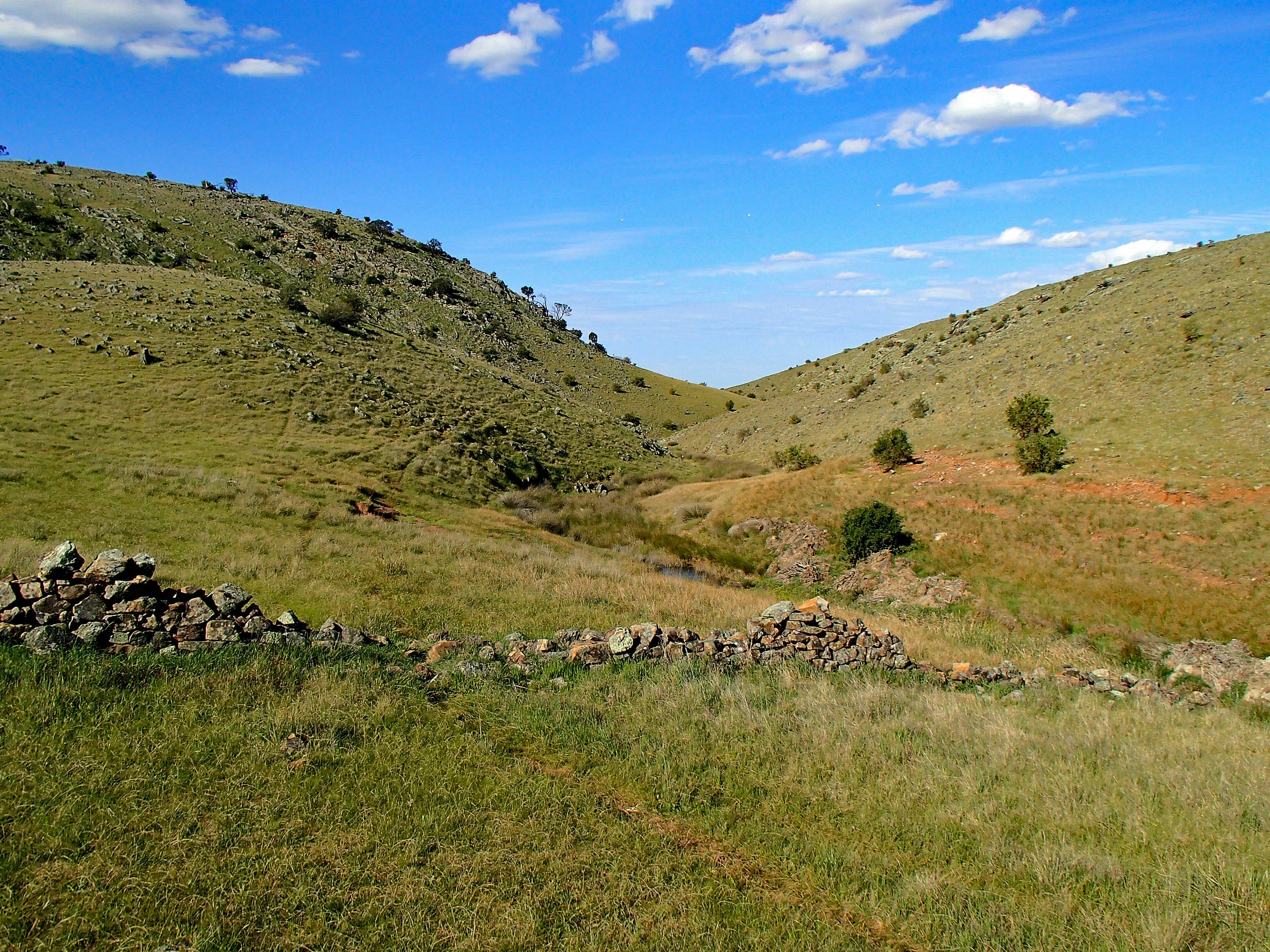
A series of road reserves and minor roads lead to Keynes Gap and Marne Rocks, both attractive photogenic locations. The southern leg of the Eden Valley Loop Trail connects with the main trail near Keynes Gap.
Keynes Gap to Keyneton,12 kilometers.
Heading north, the trail follows a shallow valley to a long cross-country section along a ridge with extensive views east & west. Onto Saw Mill Road, the Keyneton Spur Trail (3.5 km) heads easterly at this location. Reaching Angaston Road, Keyneton is 1 km east.
Keyneton to Moculta.
Continuing north, the trail follows minor roads and road reserves. Near Moculta, Parrot Hill Road is reached. Head north to Keyneton Road. Keyneton is 1km east.
Highlights in this section include well-preserved dry-stone walls, historical monuments, vineyards and old churches.
Moculta to Truro Spur Trail, 9 kilometers.
The trail leaves Keyneton Road on Gum Flat Road where there are some interesting signs. Heading west, the Swan Reach-Stockwell pipeline is followed for a short distance. Where the trail heads north, look out for the Shannon Mausoleum amongst the trees.
A long straight off-road section over undulating countryside takes you to Coppermine Road.
Truro Spur to Sturt Highway, 5 kilometers.
The trail heads north for 500 metres then heads east onto private property. Initially following an old stone wall, turns north then drops into a spectacular gorge with permanent water. Heavy rain may make this section impassable. Through the gorge, climb out of the gorge up the ridge heading north to a road reserve, the extension of Coppermine Road to the Sturt Highway.
Lavender Federation Trail; Section 1, Murray Bridge to Mount Beevor
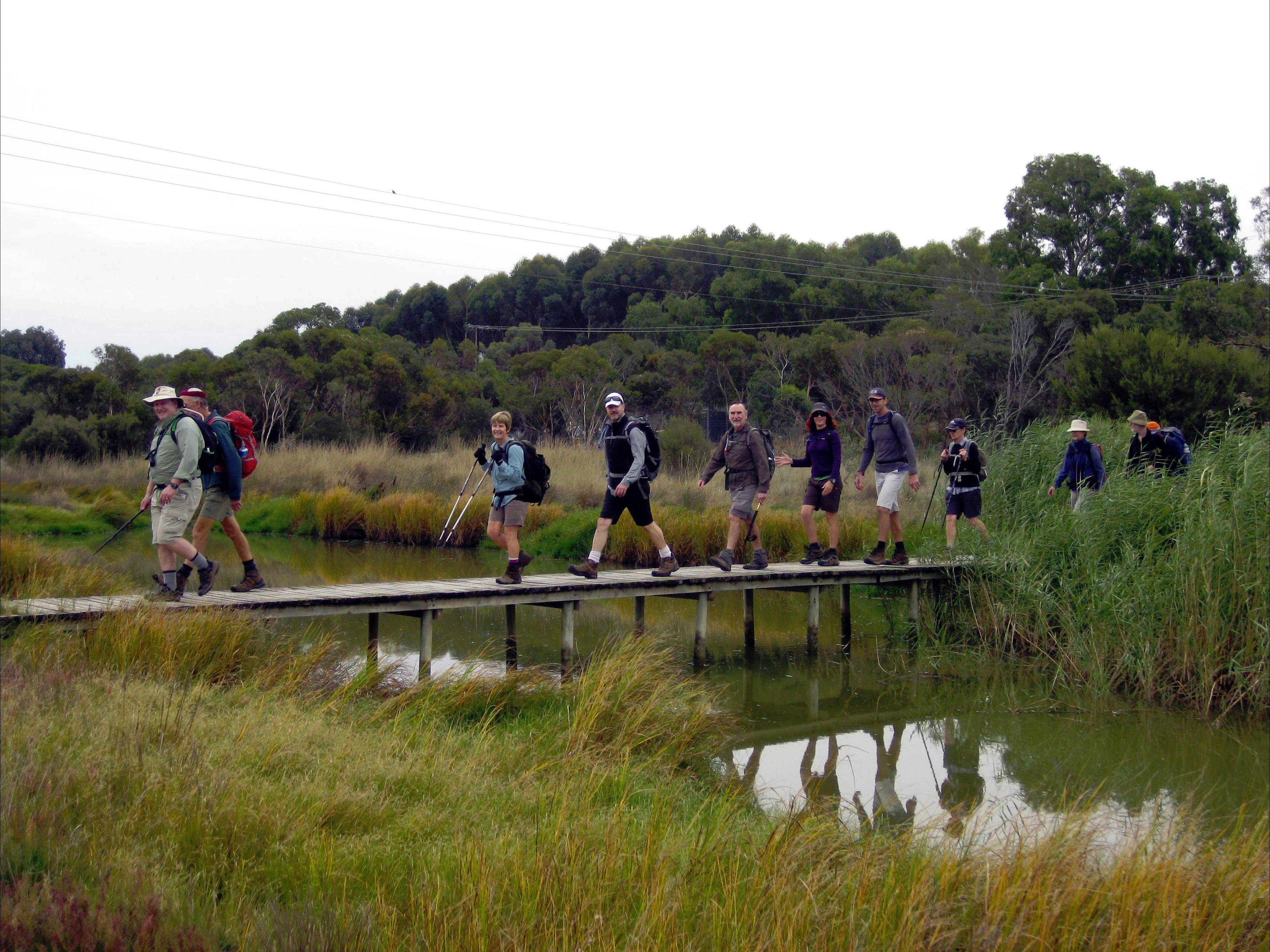
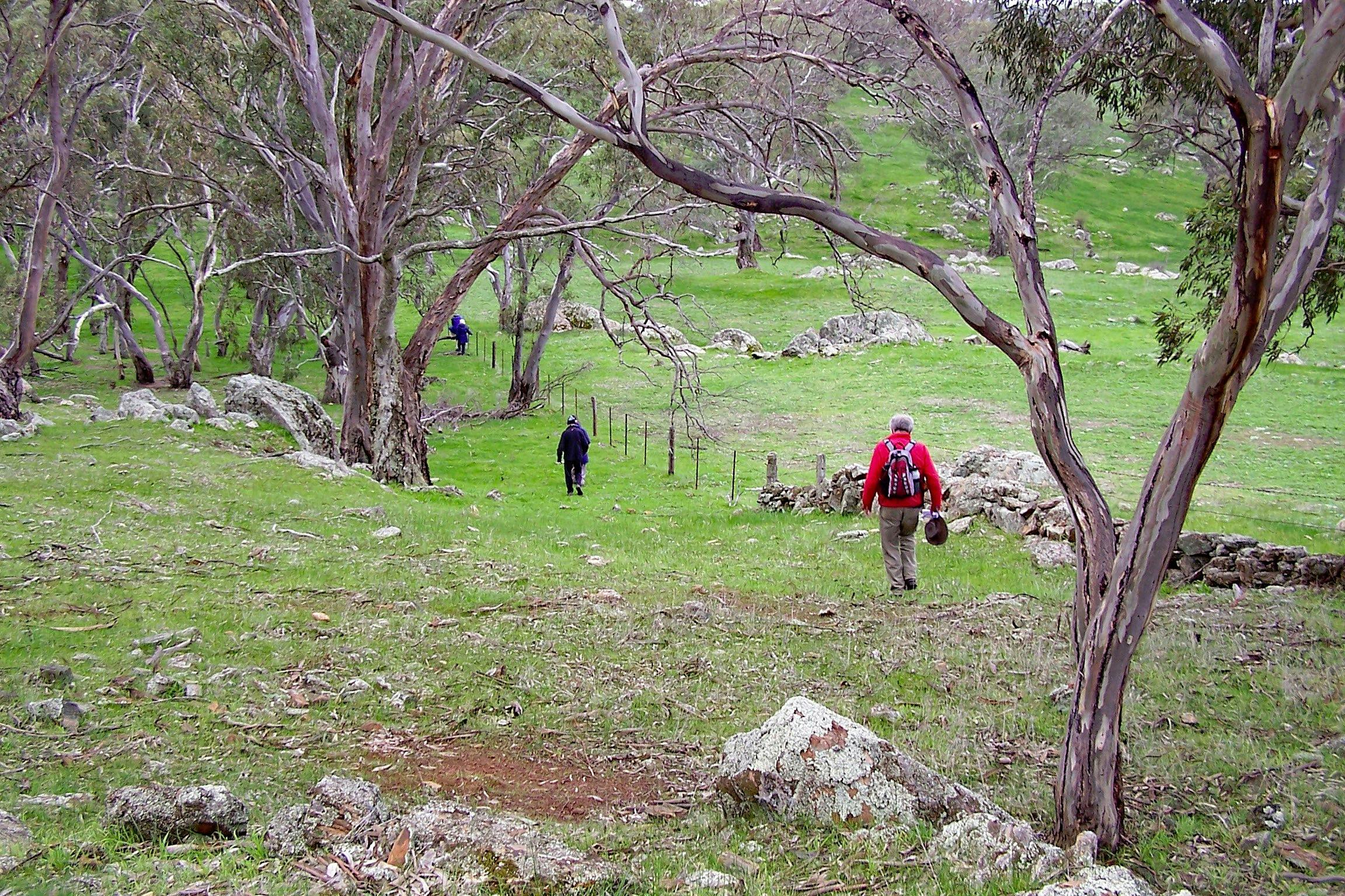
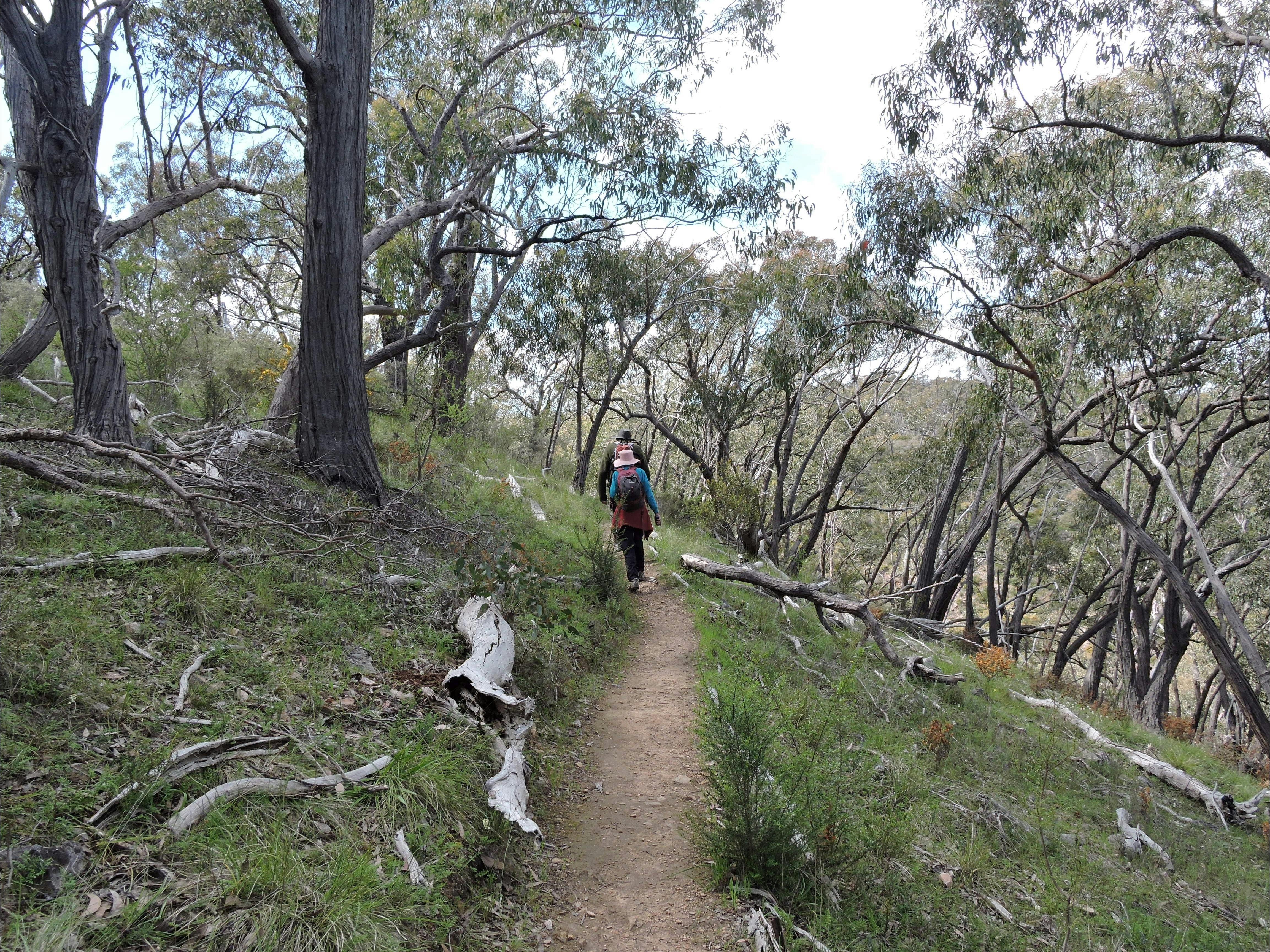
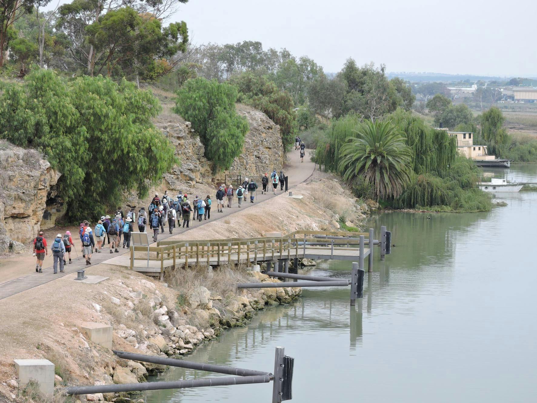
The trail commences on the banks of the Murray River at Sturt Reserve in Murray Bridge. Heading upstream, the trail passes old river boats undergoing restoration, around wetlands before following the edge of the main Adelaide- Melbourne rail line into Rocky Gully, within Kinchina Conservation Park. Rocky Gully has steep rugged gorges with an abundance of native flora, fauna and wildlife. Here, the trail connects to an extensive trail network within Kinchina CP.
At the western end of Kinchina, a road reserve takes the trail along the southern edge of the 1500 ha Monarto Safari Park, Views of exotic animals including giraffe, Mongolian Wild Horses and antelope can usually be seen.
North along a disused rail track, the Monarto Recreation Reserve is reached, a popular overnight stop with shelter, toilets and BBQ. Heading west on Hartman Road, the trail enters Crown Land through native vegetation, past the ruins of an old post office before heading north, onto private property, over the Murray Bridge to Onkaparinga pipeline onto sections of unmade back roads, road reserves & private property. Then, in one section the trail passes the National Trust listed Preamimma Mine; further on, another follows Gum Gully Creek climbing steadily.
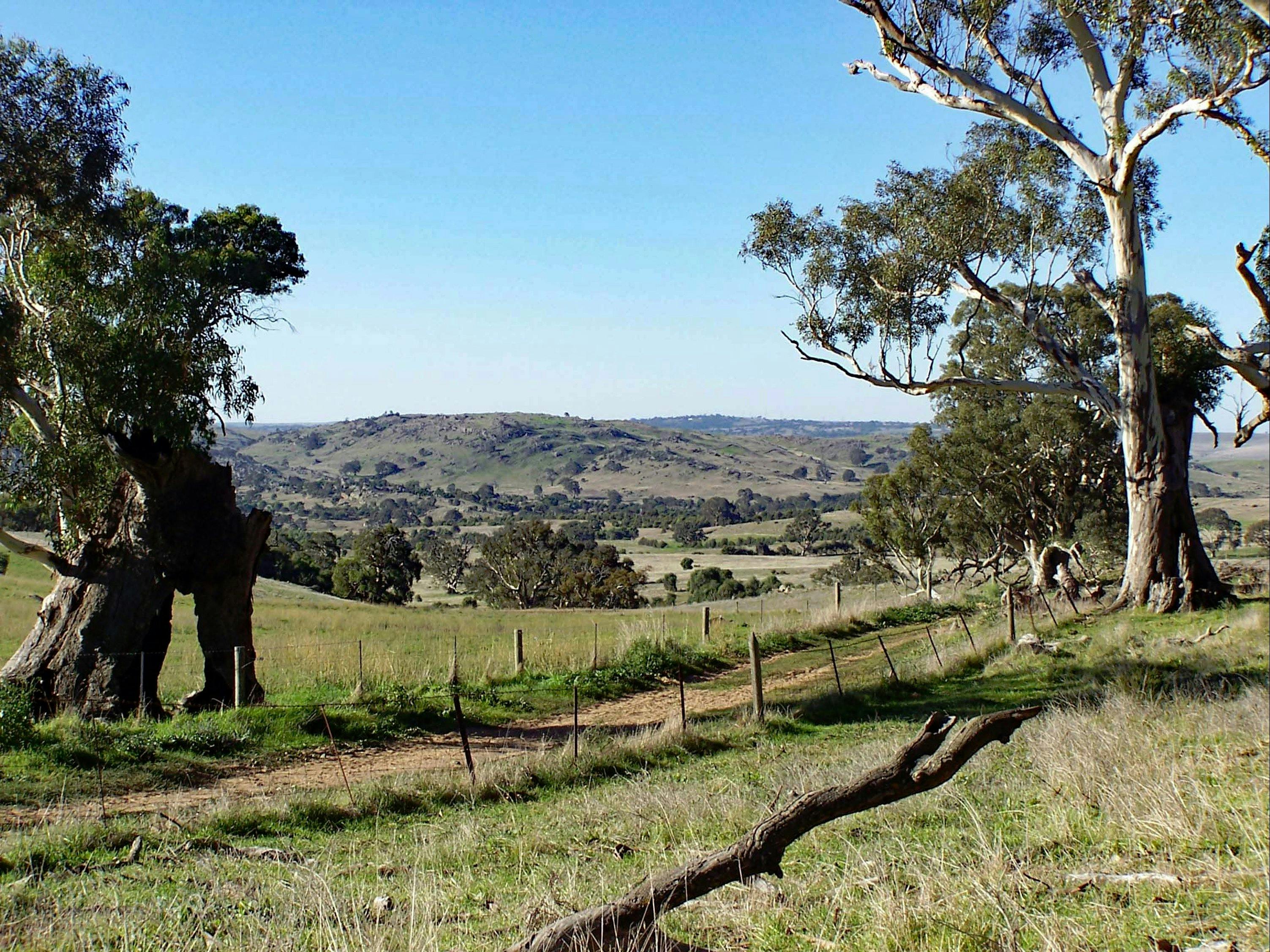
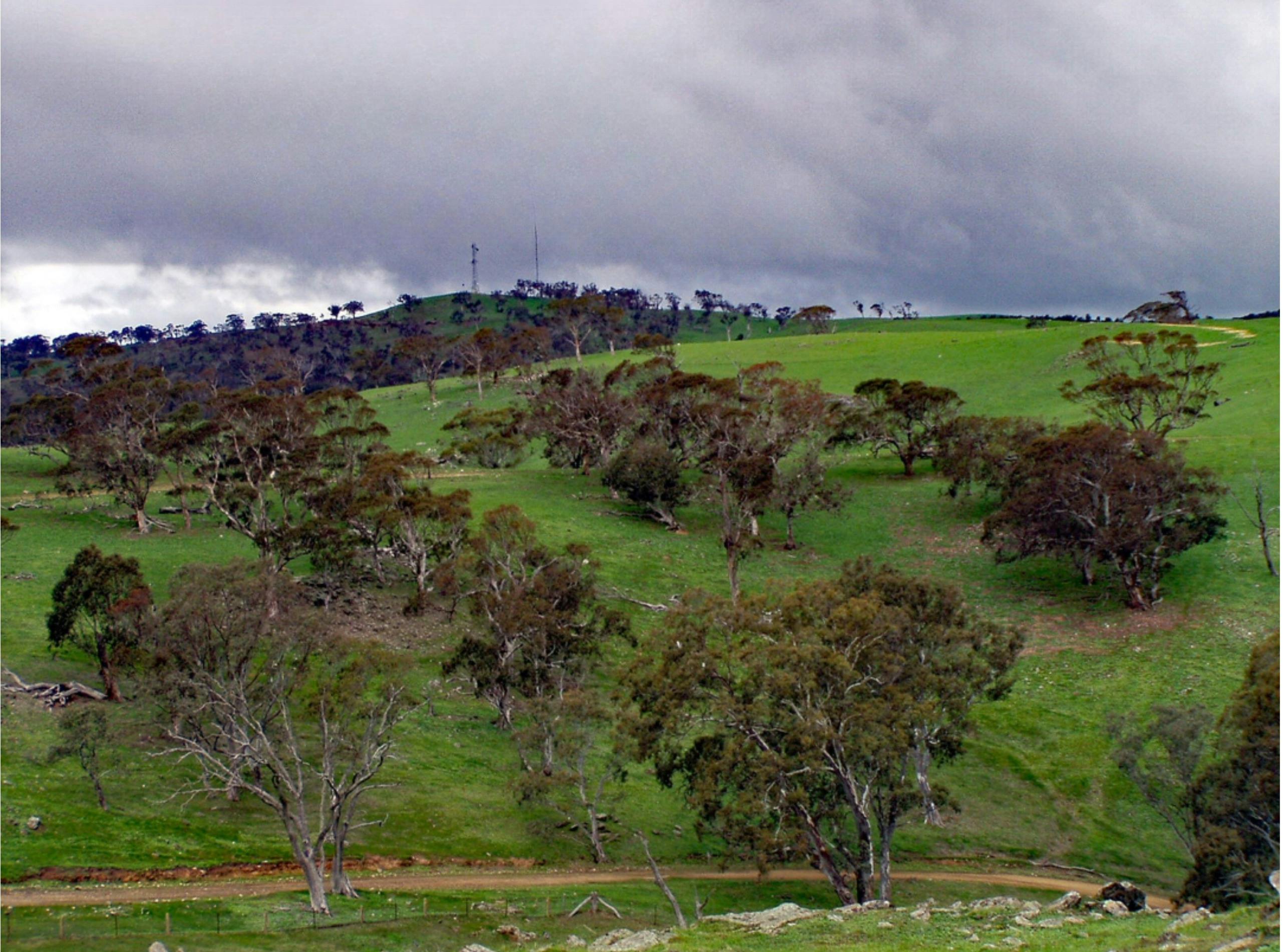
The trail then begins climbing the eastern slopes of the Mt Lofty Ranges where many spots offer wide views of the surrounding countryside.
The final section to the 505 metre summit of Mount Beevor is very steep however the 360-degree views are stunning. The Southern Ocean and Coorong south, Mount Barker & Mount Lofty west, Murray River east & Barossa Range north.
Mount Beevor to Springton
The second part of the Lavender Federation Trail commences at Mount Beevor. It can also be accessed from Diggers Rest via a spur trail. The main trail is about 1 km long, with the summit located an additional 2 km south.
The 505-metre-high Mount Beevor offers stunning 360-degree views.
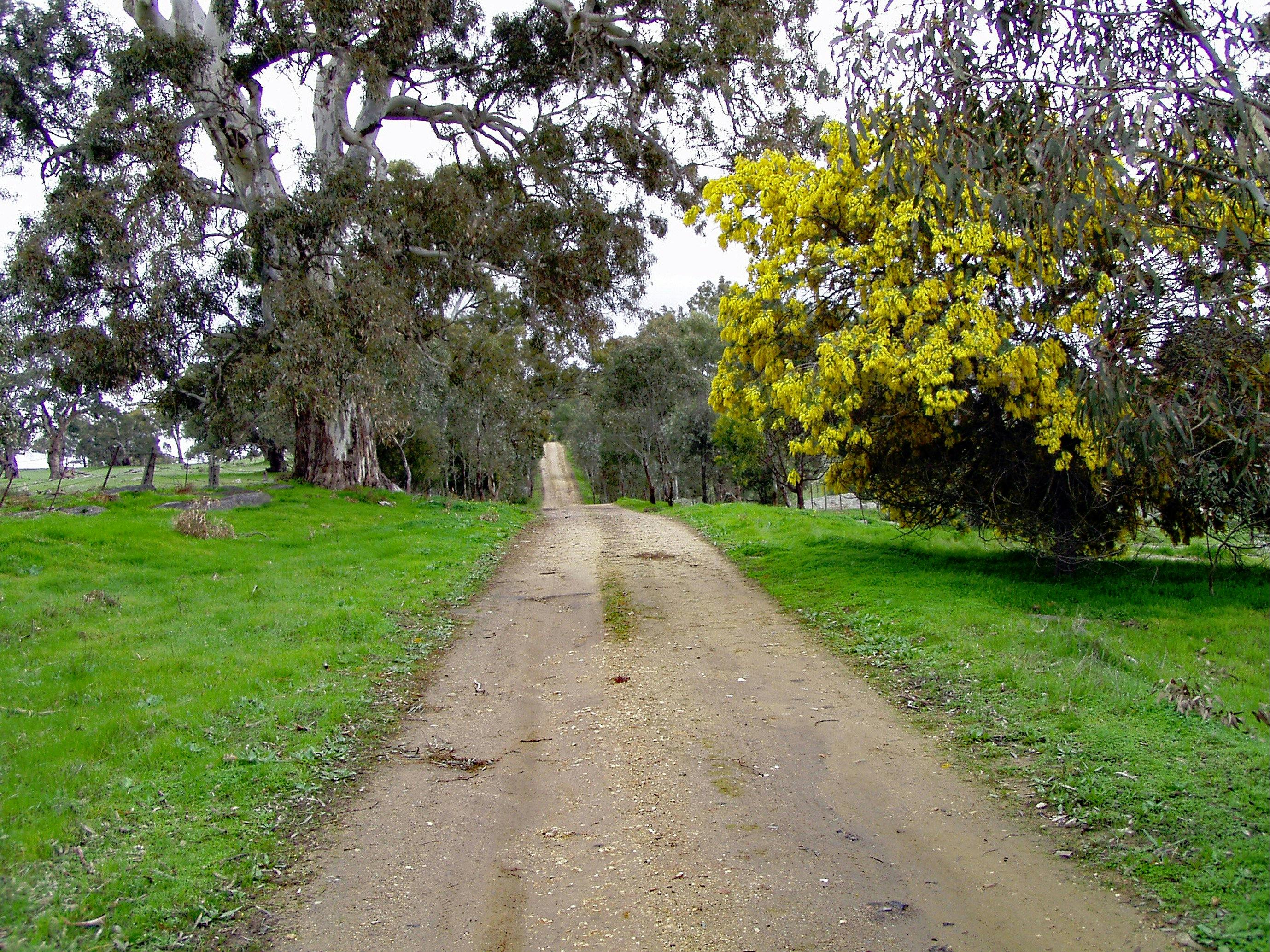
Heading northwards, the trail descends, crosses Muir Creek, onto Fendler’s Road for a short distance, off road then onto Brinkworth Road. Leaving the road, the surrounds offer towering eucalypts, panoramic views and abundant wildlife. Onto Collins Road, the site of Bakers Dairies, supplier of cheese to the Victorian Goldfields from the 1840s. North of the dairies was the main bullock track that was used to cart copper from the Reedy Creek Copper Mine. West was the Blacksmith Arms Hotel built in 1851 supplying thirsty bullock drivers. Leaving the road, follow Bakers Creek to Woolshed Road. A 100m detour west is Hoads Woolshed built in 1858.
Next: Tungkillo, a small quaint township founded in 1861, 60 km from Adelaide. The Mannum to Adelaide water pipeline cuts through the township. The Soldiers Memorial Hall, west as you enter the town offers a good stop Location.
The next leg of the trail to Springton, 27 km, is a tough one day walk. The trail initially follows back roads, unmade road reserves and open countryside with rocky outcrops and wide sweeping panoramas extending south to Mt Beevor are magnificent. Crossing the Angus Valley Road onto more open country, the east end of Lucas Back Road is covered with native trees. Sheep grazing and eucalyptus plantations gradually are replaced by grape vines as the trail reaches Springton.
Mount Beevor to Springton 47km
Diggers Rest Spur Trail 1.5km
Mount Beevor to Tungkillo 20km
Tungkillo to Mount Pleasant Sedan Road 17km
Mt Pleasant Sedan Road to Springton 10km
Tungkillo Loop Trail 17km

Truro to Eudunda
Sturt Highway to Eudunda, 55.6 km. There are long sections between access points of up to 15 km. It is recommended only experienced walkers undertake most of these sections. Be aware of some very exposed areas and some very steep climbs and descents.
Sturt Highway to Dutton, 15.1 km.
Take care. The Sturt Highway crossing is a 110 kph speed limit.
A meandering route on road reserves before heading north on “Wild Dog Track”. Then, Waterfall Creek is crossed before heading west through “The Gap.” Almost unknown until the generosity of the local landowner made it accessible to walkers, this is a picturesque location with permanent water. Then follow Pine Creek and a minor road into Dutton.
Dutton to Leakes Pass Road. 14.3km.
From 6 occupied houses in the late 1940s, a population revival and restoration from the 1970s makes the Dutton Spur Trail a worthwhile diversion.
Leaving Dutton on secondary roads, the Truro to Eudunda Road is followed for 3 km before heading westward. Then, around the base of Mount Rufus before climbing to the summit of Leakes Lookout with 360-degree views.
A steep decent northwards, walk through grazing land, a wide deep creek into a wooded area and onto Leakes Pass Road.
Leakes Pass Road to Footeside Farm 12.2 km
Progressing northwards, a short section of road reserve connects to Smith Road providing a scenic route westward through Narcoota Springs, a watering place of early explorers and rare source of permanent water.
Climbing out of the reserve back onto Smith Road until leaving the road to climb an undulating path to follow the Truro- Eudunda Road to Footeside Farm where prebooked overnight accommodation is available.
Footeside Farm to Eudunda 14 km
Follow Foote Creek to Woithe Road noting the historic monument. Continue along Woithe Road to Von Reiben Road then cross the main road onto Nicholson Road, onto road reserves that then head towards Eudunda.
An aqueduct that collected water for steam trains forms the route to the golf course, showground, oval and swimming pool. The final section follows the disused Eudunda to Morgan rail track into Eudunda.

Lavender Federation Trail
Eudunda to Manoora-52 km.
Initially heading north, then west, most of the trail is off road using unmade road reserves, private property or minor roads. The trail is sometimes undulating with one steep section at Webb Gap.
Eudunda to Hampden-4 km.
Initially, the route is through the Colin Thiele Gardens, then via a short detour through the main street before rejoining the rail corridor on a recently upgraded rail trail to Hampden. A short detour at Hampden takes you to the old railway station.
Hampden to Inspiration Point-19 km
The main trail leaves the rail corridor before Hampden, crosses private land past a disused rabbit cannery to aptly named Scenic Road. The Point Pass loop Trail (14 km) leaves & rejoins the main trail along this section. A spur trail descends to Robertstown at Inspiration Point.
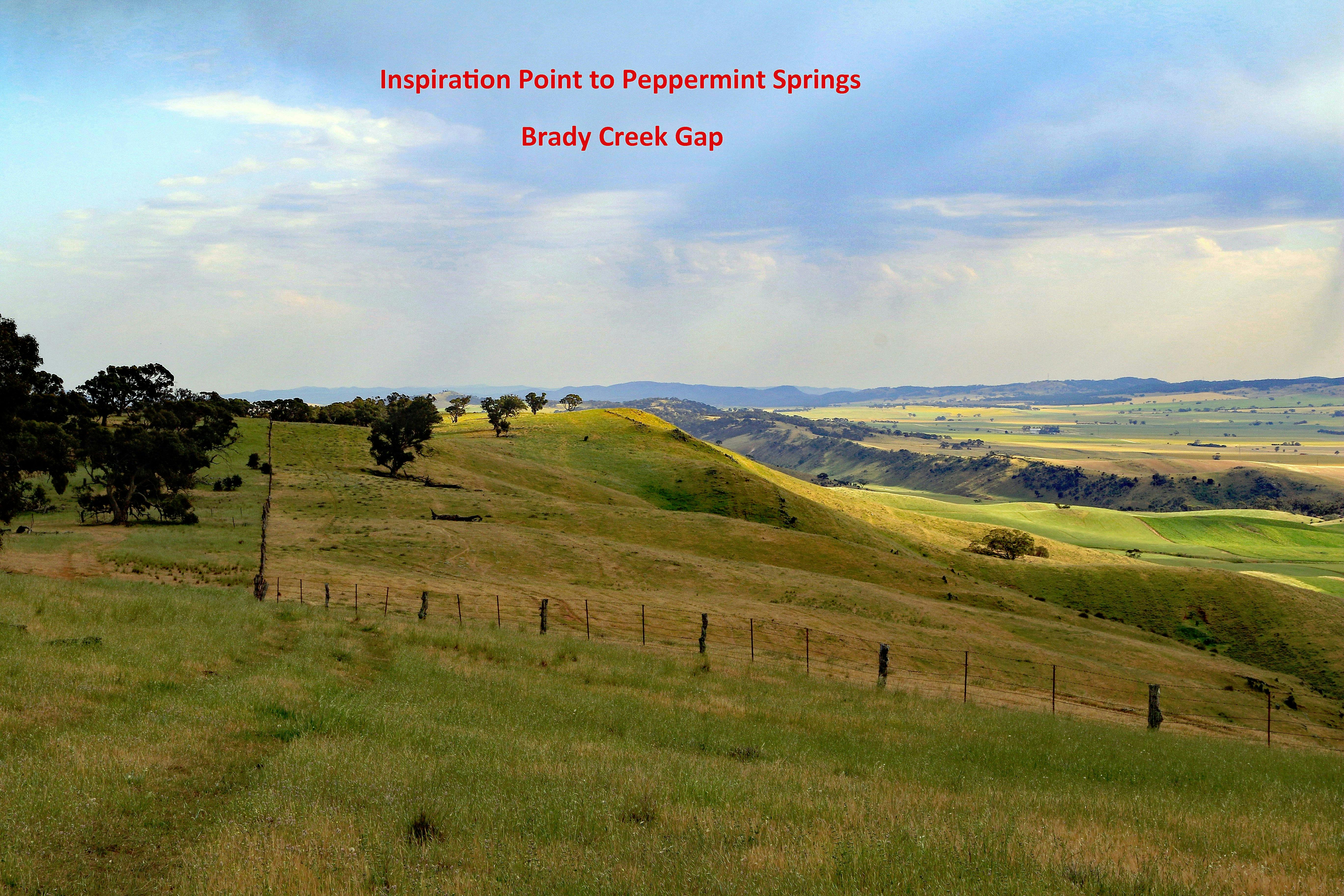
Inspiration Point to Webb Gap-8 km.
Inspiration Point has a shelter & seating positioned to enjoy panoramic views to the east. The next section is all off road, mainly on private land. The Tothill Ranges appear to the west then “Peppermint Springs” homestead is passed.
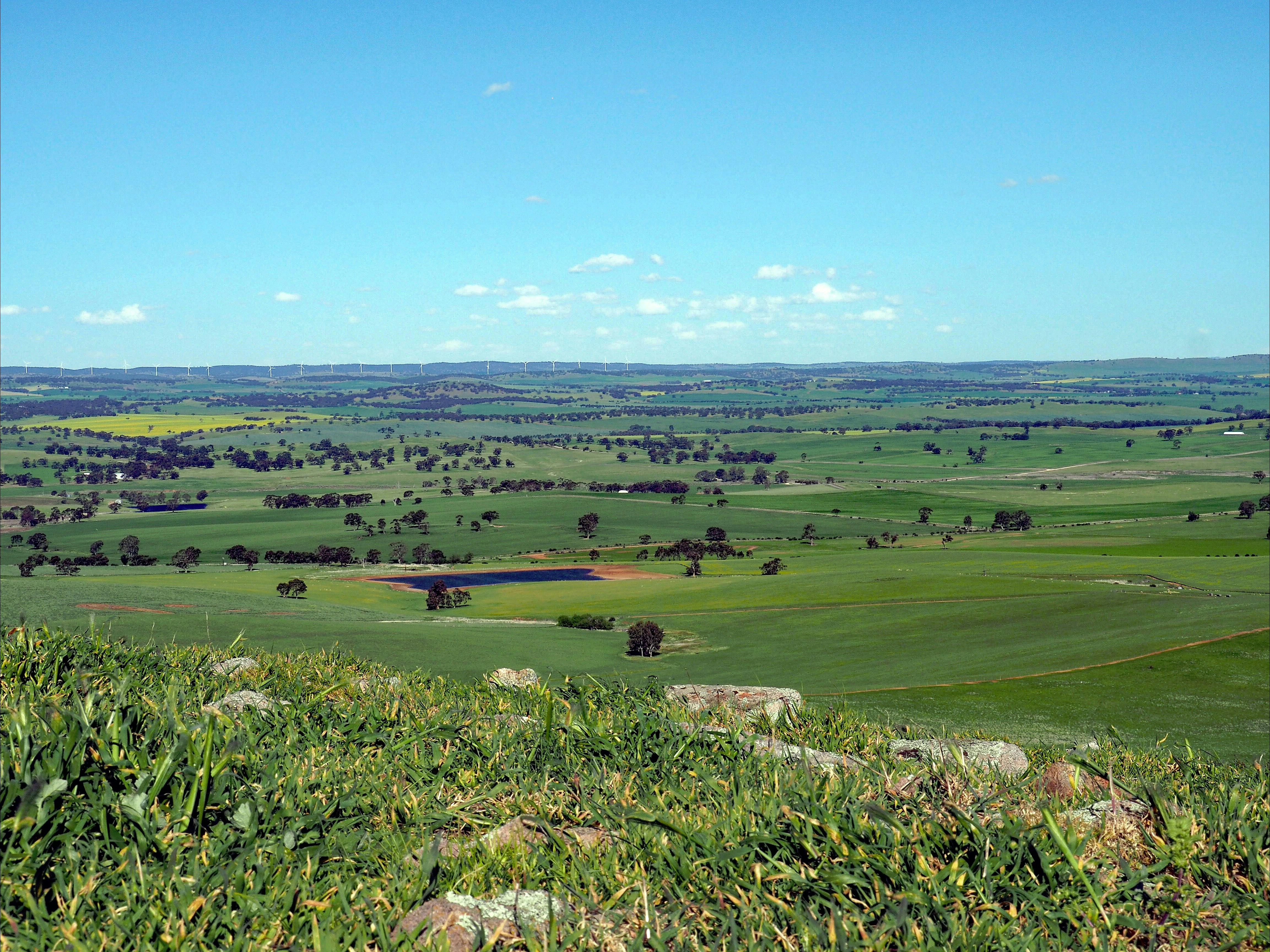
Webb Gap to Waterloo-13 km.
Webb Gap is the location where the LFT & Heysen Trail meet. A shelter & water are located off the minor road shared by both trails. From Webb Gap to Moller Gap the trail follows minor roads. From there to Quinn Gap, is adjacent to the Waterloo wind farm with views of the Tothill Ranges and Apoina Lagoon. Quinn s Gap Road leads to Waterloo with facilities at Tom Cruize Park.
Waterloo to Manoora-8 km.
Leaving Waterloo, Milde Road leads to a road reserve, onto Palmer Road & into Manoora. The Centenary Park has facilities.